Area Overview for SP5 5PD
Photos of SP5 5PD


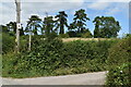

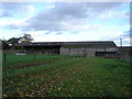


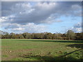

15 photos from this area
Area Information
Key information about the SP5 5PD including its size, population, and administrative classification.
- Area Type
- Postcode
- Area Size
- 65.2 hectares
- Population
- 1419
- Population Density
- 40 people/km²
House Prices in SP5 5PD
18
Properties
£392,667
Average Sold Price
£97,000
Lowest Price
£795,000
Highest Price
Showing 18 properties
| Address | Type | Beds | Baths | Last Sale Price | Last Sale Date | |
|---|---|---|---|---|---|---|
| Rose Cottage, Dean Lane, Deanland, Sixpenny Handley, SP5 5PD | Detached | 4 | 2 | £627,000 | Mar 2025 | |
| Incewood, Dean Lane, Deanland, Sixpenny Handley, SP5 5PD | house | - | - | £795,000 | Aug 2021 | |
| Kete Cottage, Dean Lane, Deanland, Sixpenny Handley, SP5 5PD | house | 4 | - | £605,000 | Dec 2014 | |
| Stoneacre, Dean Lane, Deanland, Sixpenny Handley, SP5 5PD | house | - | - | £460,000 | Apr 2011 | |
| Tiny Cottage, Dean Lane, Deanland, Sixpenny Handley, SP5 5PD | Detached | 3 | - | £275,000 | Jul 2007 | |
| Paddock Cottage, Dean Lane, Deanland, Sixpenny Handley, SP5 5PD | house | - | - | £350,000 | Jun 2002 | |
| Tanglewood, Dean Lane, Deanland, Sixpenny Handley, SP5 5PD | Detached | - | - | £185,000 | Nov 1998 | |
| Chalk Cottage, Dean Lane, Deanland, Sixpenny Handley, SP5 5PD | house | - | - | £140,000 | Sep 1996 | |
| Inacille Cottage, Dean Lane, Deanland, Sixpenny Handley, SP5 5PD | house | - | - | £97,000 | Mar 1996 | |
| Cartwheels, Dean Lane, Deanland, Sixpenny Handley, SP5 5PD | Detached | 3 | 2 | - | - |
Page 1 of 2
Energy Efficiency in SP5 5PD
Amenities
Schools
| Rank | School | Type | Entry gender | Ages |
|---|
Explore more schools in this area
Go to Schools tabDemographics
Household Size
Two person
most common
Accommodation Type
Houses
most common
Tenure
65
majority
Ethnic Group
White
most common
Religion
N/A
most common
Household Composition
N/A
most common
Age
47
median
Adults (30-64 years)
most common
Household Deprivation
N/A
with no deprivation
NS-SEC
37
in Lower managerial occupations
Explore more demographic insights in this area
Go to Demographics tabPlanning
Planning Constraints
- Flood RiskPremium
- Ramsar Wetland SitesPremium
- Area of Outstanding Natural BeautyPremium
- Protected Nature ReservePremium
- Protected WoodlandPremium