Area Overview for SP5 4LR
Photos of SP5 4LR
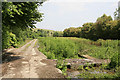
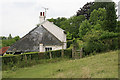
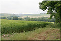
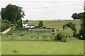
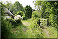
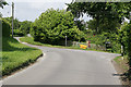
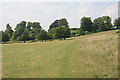
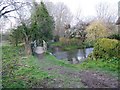
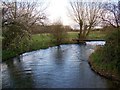
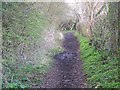
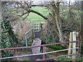
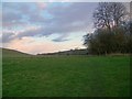
64 photos from this area
Area Information
Key information about the SP5 4LR including its size, population, and administrative classification.
- Area Type
- Postcode
- Area Size
- 10.4 hectares
- Population
- 2161
- Population Density
- 52 people/km²
House Prices in SP5 4LR
27
Properties
£738,969
Average Sold Price
£220,000
Lowest Price
£1,840,000
Highest Price
Showing 27 properties
| Address | Type | Beds | Baths | Last Sale Price | Last Sale Date | |
|---|---|---|---|---|---|---|
| Old Rectory House, Homington Road, Coombe Bissett, SP5 4LR | Detached | 5 | 3 | £900,000 | Mar 2025 | |
| Cross Stone, Homington Road, Coombe Bissett, SP5 4LR | Character Property | 3 | 2 | £770,000 | Mar 2025 | |
| Brines Cottage, Homington Road, Coombe Bissett, SP5 4LR | house | - | - | £410,000 | Dec 2020 | |
| The Glebe, Homington Road, Coombe Bissett, SP5 4LR | Detached | 6 | 5 | £1,555,000 | May 2019 | |
| Thatch House, Homington Road, Coombe Bissett, SP5 4LR | house | - | - | £500,000 | Dec 2016 | |
| The Brines, Homington Road, Coombe Bissett, SP5 4LR | Semi-detached | 2 | 1 | £450,000 | Jan 2016 | |
| Brook House, Homington Road, Coombe Bissett, SP5 4LR | Detached | - | - | £1,300,000 | Oct 2015 | |
| Church Farm Barn, Homington Road, Coombe Bissett, SP5 4LR | house | - | - | £750,000 | May 2013 | |
| Home Close, Homington Road, Coombe Bissett, SP5 4LR | Bungalow | - | - | £425,000 | Apr 2011 | |
| Lime Tree House, Homington Road, Coombe Bissett, SP5 4LR | Detached | - | - | £585,000 | Jul 2008 |
Page 1 of 3
Energy Efficiency in SP5 4LR
Amenities
Schools
| Rank | School | Type | Entry gender | Ages |
|---|
Explore more schools in this area
Go to Schools tabDemographics
Household Size
Two person
most common
Accommodation Type
Houses
most common
Tenure
64
majority
Ethnic Group
White
most common
Religion
N/A
most common
Household Composition
N/A
most common
Age
47
median
Adults (30-64 years)
most common
Household Deprivation
N/A
with no deprivation
NS-SEC
46
in Lower managerial occupations
Explore more demographic insights in this area
Go to Demographics tabPlanning
Planning Constraints
- Flood RiskPremium
- Ramsar Wetland SitesPremium
- Area of Outstanding Natural BeautyPremium
- Protected Nature ReservePremium
- Protected WoodlandPremium