Area Overview for SP5 4DY
Photos of SP5 4DY
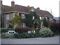
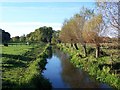
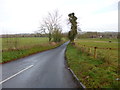
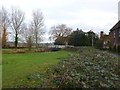
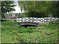
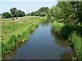
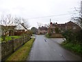
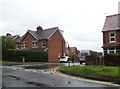
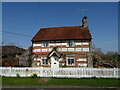
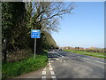
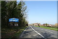
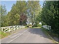
43 photos from this area
Area Information
Key information about the SP5 4DY including its size, population, and administrative classification.
- Area Type
- Postcode
- Area Size
- 63.4 hectares
- Population
- 1300
- Population Density
- 1779 people/km²
House Prices in SP5 4DY
16
Properties
£497,500
Average Sold Price
£350,000
Lowest Price
£657,500
Highest Price
Showing 16 properties
| Address | Type | Beds | Baths | Last Sale Price | Last Sale Date | |
|---|---|---|---|---|---|---|
| The Fishing Lodge East, Lower Road, Britford, SP5 4DY | Semi-detached | 5 | 3 | £657,500 | Jan 2019 | |
| The Fishing Lodge West, Lower Road, Britford, SP5 4DY | house | - | - | £485,000 | Nov 2018 | |
| The Cheese House, Lower Road, Britford, SP5 4DY | house | 5 | - | £350,000 | Jan 2005 | |
| Unit 15, Bridge Farm, Lower Road, Britford, SP5 4DY | office_workshop | - | - | - | - | |
| Tennis 80M From River Cottage, Lower Road 88M From Lower Road, Lower Road, Britford, SP5 4DY | Leisure | - | - | - | - | |
| Meadows Reach, Lower Road, Britford, SP5 4DY | Detached | - | - | - | - | |
| The Net House, Lower Road, Britford, SP5 4DY | Detached | - | - | - | - | |
| Bridge Cottage, Lower Road, Britford, SP5 4DY | Cottage | 3 | - | - | - | |
| Coote Cottage, Lower Road, Britford, SP5 4DY | Detached | - | - | - | - | |
| Bridge House, Lower Road, Britford, SP5 4DY | Detached | - | - | - | - |
Page 1 of 2
Energy Efficiency in SP5 4DY
Amenities
Schools
| Rank | School | Type | Entry gender | Ages |
|---|
Explore more schools in this area
Go to Schools tabDemographics
Household Size
Two person
most common
Accommodation Type
Houses
most common
Tenure
79
majority
Ethnic Group
White
most common
Religion
N/A
most common
Household Composition
N/A
most common
Age
47
median
Adults (30-64 years)
most common
Household Deprivation
N/A
with no deprivation
NS-SEC
46
in Lower managerial occupations
Explore more demographic insights in this area
Go to Demographics tabPlanning
Planning Constraints
- Flood RiskPremium
- Ramsar Wetland SitesPremium
- Area of Outstanding Natural BeautyPremium
- Protected Nature ReservePremium
- Protected WoodlandPremium