Area Overview for SP5 3RF
Photos of SP5 3RF
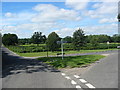
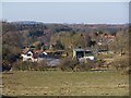
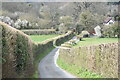

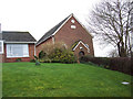

6 photos from this area
Area Information
Key information about the SP5 3RF including its size, population, and administrative classification.
- Area Type
- Postcode
- Area Size
- 3.8 hectares
- Population
- 1200
- Population Density
- 92 people/km²
House Prices in SP5 3RF
15
Properties
£492,861
Average Sold Price
£10,000
Lowest Price
£1,275,000
Highest Price
Showing 15 properties
| Address | Type | Beds | Baths | Last Sale Price | Last Sale Date | |
|---|---|---|---|---|---|---|
| High Ridge, Grimstead Road, West Grimstead, SP5 3RF | Bungalow | 4 | 1 | £595,000 | Nov 2024 | |
| The Old Rectory, Grimstead Road, West Grimstead, SP5 3RF | Detached | 6 | 3 | £10,000 | Mar 2024 | |
| Rowdens Farm, Grimstead Road, West Grimstead, SP5 3RF | Detached | 3 | 3 | £1,275,000 | Jun 2023 | |
| Treyarnon, Grimstead Road, West Grimstead, SP5 3RF | Bungalow | 3 | 2 | £530,500 | Apr 2022 | |
| Croftdown, Grimstead Road, West Grimstead, SP5 3RF | Bungalow | 3 | - | £379,250 | Aug 2019 | |
| The School House, Grimstead Road, West Grimstead, SP5 3RF | house | - | - | £485,000 | Oct 2017 | |
| Quoin House, Grimstead Road, West Grimstead, SP5 3RF | house | - | - | £470,000 | Nov 2009 | |
| Hedge End, Grimstead Road, West Grimstead, SP5 3RF | Detached | - | - | £315,000 | Apr 2007 | |
| Swaynes Farmhouse, Grimstead Road, West Grimstead, SP5 3RF | house | - | - | £376,000 | May 2004 | |
| Knap House, West From West Dean Farm To Grimstead Road, West Grimstead, SP5 3RF | house | 5 | 3 | - | - |
Page 1 of 2
Energy Efficiency in SP5 3RF
Amenities
Schools
| Rank | School | Type | Entry gender | Ages |
|---|
Explore more schools in this area
Go to Schools tabDemographics
Household Size
Two person
most common
Accommodation Type
Houses
most common
Tenure
70
majority
Ethnic Group
White
most common
Religion
N/A
most common
Household Composition
N/A
most common
Age
47
median
Adults (30-64 years)
most common
Household Deprivation
N/A
with no deprivation
NS-SEC
39
in Lower managerial occupations
Explore more demographic insights in this area
Go to Demographics tabPlanning
Planning Constraints
- Flood RiskPremium
- Ramsar Wetland SitesPremium
- Area of Outstanding Natural BeautyPremium
- Protected Nature ReservePremium
- Protected WoodlandPremium