Area Overview for SP5 3ND
Photos of SP5 3ND
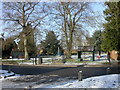
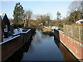
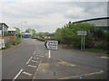
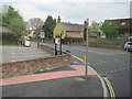
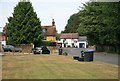
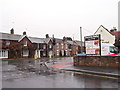
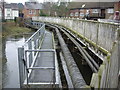
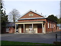
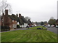

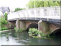
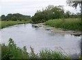
95 photos from this area
Area Information
Key information about the SP5 3ND including its size, population, and administrative classification.
- Area Type
- Postcode
- Area Size
- 5.1 hectares
- Population
- 1424
- Population Density
- 577 people/km²
House Prices in SP5 3ND
32
Properties
£327,239
Average Sold Price
£60,000
Lowest Price
£770,000
Highest Price
Showing 32 properties
| Address | Type | Beds | Baths | Last Sale Price | Last Sale Date | |
|---|---|---|---|---|---|---|
| 40 The Borough, Downton, SP5 3ND | house | - | - | £250,000 | Mar 2023 | |
| 30 The Borough, Downton, SP5 3ND | house | - | - | £360,000 | Mar 2021 | |
| 34 The Borough, Downton, SP5 3ND | Cottage | 3 | 2 | £430,000 | Apr 2020 | |
| 50 The Borough, Downton, SP5 3ND | Terraced | - | - | £395,000 | Dec 2019 | |
| Foxes Sleep, 42 The Borough, Downton, SP5 3ND | Detached | 4 | 3 | £495,000 | Oct 2019 | |
| 22 The Borough, Downton, SP5 3ND | Detached | 4 | 2 | £667,500 | Oct 2019 | |
| 46 The Borough, Downton, SP5 3ND | house | - | - | £341,995 | May 2017 | |
| 52 The Borough, Downton, SP5 3ND | Cottage | 3 | - | £495,000 | Dec 2016 | |
| 2 The Borough, Downton, SP5 3ND | house | - | - | £154,000 | Aug 2015 | |
| 16 The Borough, Downton, SP5 3ND | Terraced | 3 | - | £313,000 | Nov 2014 |
Page 1 of 4
Energy Efficiency in SP5 3ND
Amenities
Schools
| Rank | School | Type | Entry gender | Ages |
|---|
Explore more schools in this area
Go to Schools tabDemographics
Household Size
Two person
most common
Accommodation Type
Houses
most common
Tenure
76
majority
Ethnic Group
White
most common
Religion
N/A
most common
Household Composition
N/A
most common
Age
47
median
Adults (30-64 years)
most common
Household Deprivation
N/A
with no deprivation
NS-SEC
35
in Lower managerial occupations
Explore more demographic insights in this area
Go to Demographics tabPlanning
Planning Constraints
- Flood RiskPremium
- Ramsar Wetland SitesPremium
- Area of Outstanding Natural BeautyPremium
- Protected Nature ReservePremium
- Protected WoodlandPremium