Area Overview for SP5 2QE
Photos of SP5 2QE


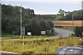
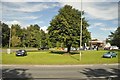
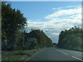

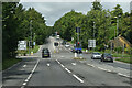
15 photos from this area
Area Information
Key information about the SP5 2QE including its size, population, and administrative classification.
- Area Type
- Postcode
- Area Size
- 2.3 km²
- Population
- 1549
- Population Density
- 64 people/km²
House Prices in SP5 2QE
16
Properties
£702,500
Average Sold Price
£435,000
Lowest Price
£970,000
Highest Price
Showing 16 properties
| Address | Type | Beds | Baths | Last Sale Price | Last Sale Date | |
|---|---|---|---|---|---|---|
| Pepperbox House, Brickworth Lane, Whiteparish, SP5 2QE | Detached | 4 | 3 | £970,000 | May 2023 | |
| Barn End, Brickworth Lane, Whiteparish, SP5 2QE | Detached | - | - | £435,000 | Oct 1997 | |
| The Granary, Brickworth Lane, Whiteparish, SP5 2QE | Detached | 6 | 5 | - | - | |
| Paddock View, Brickworth Farm, Brickworth Lane, Whiteparish, SP5 2QE | Bungalow | 3 | 2 | - | - | |
| The Coach House, Brickworth Lane, Whiteparish, SP5 2QE | house | - | - | - | - | |
| Lower Bush Farm, A 36 Windwhistle Lane Southeast To Brickworth Road, Whiteparish, SP5 2QE | Detached | - | - | - | - | |
| Brickworth Bungalow, Brickworth Road, Whiteparish, SP5 2QE | Bungalow | - | - | - | - | |
| Brickworth Farmhouse, Brickworth Lane, Whiteparish, SP5 2QE | Detached | - | - | - | - | |
| Brickworth Down Farm, A 36 Windwhistle Lane Southeast To Brickworth Road, Whiteparish, SP5 2QE | house | - | - | - | - | |
| M L Electronics, Brickworth Farm, Brickworth Lane, Whiteparish, SP5 2QE | Office | - | - | - | - |
Page 1 of 2
Energy Efficiency in SP5 2QE
Amenities
Schools
| Rank | School | Type | Entry gender | Ages |
|---|
Explore more schools in this area
Go to Schools tabDemographics
Household Size
Two person
most common
Accommodation Type
Houses
most common
Tenure
82
majority
Ethnic Group
White
most common
Religion
N/A
most common
Household Composition
N/A
most common
Age
47
median
Adults (30-64 years)
most common
Household Deprivation
N/A
with no deprivation
NS-SEC
44
in Lower managerial occupations
Explore more demographic insights in this area
Go to Demographics tabPlanning
Planning Constraints
- Flood RiskPremium
- Ramsar Wetland SitesPremium
- Area of Outstanding Natural BeautyPremium
- Protected Nature ReservePremium
- Protected WoodlandPremium