Area Overview for SP5 2PN
Photos of SP5 2PN
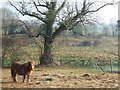
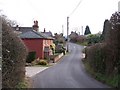
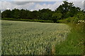
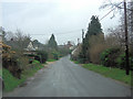
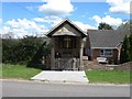
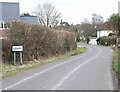
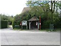


12 photos from this area
Area Information
Key information about the SP5 2PN including its size, population, and administrative classification.
- Area Type
- Postcode
- Area Size
- 5.1 hectares
- Population
- 1462
- Population Density
- 67 people/km²
House Prices in SP5 2PN
26
Properties
£316,657
Average Sold Price
£130,000
Lowest Price
£563,350
Highest Price
Showing 26 properties
| Address | Type | Beds | Baths | Last Sale Price | Last Sale Date | |
|---|---|---|---|---|---|---|
| Haverdean, Besomer Drove, Lover, SP5 2PN | Terraced | 3 | 1 | £415,000 | Mar 2024 | |
| Wyvern, Besomer Drove, Lover, SP5 2PN | house | 3 | - | £325,000 | Dec 2021 | |
| Ambleside, Besomer Drove, Lover, SP5 2PN | Detached | 4 | 2 | £563,350 | May 2019 | |
| Loverdale, Besomer Drove, Lover, SP5 2PN | Cottage | 3 | - | £545,000 | Nov 2018 | |
| Pippins, Besomer Drove, Lover, SP5 2PN | Bungalow | 3 | 1 | £382,000 | Jan 2018 | |
| Medlers, Besomer Drove, Lover, SP5 2PN | Bungalow | - | - | £325,000 | May 2017 | |
| Buttercups, Besomer Drove, Lover, SP5 2PN | Bungalow | 3 | - | £332,000 | Jun 2014 | |
| Lynwood, Besomer Drove, Lover, SP5 2PN | house | - | - | £130,000 | May 2013 | |
| Sonmie, Besomer Drove, Lover, SP5 2PN | Bungalow | - | - | £275,000 | Nov 2009 | |
| Setters, Besomer Drove, Lover, SP5 2PN | house | - | - | £274,000 | Aug 2008 |
Page 1 of 3
Energy Efficiency in SP5 2PN
Amenities
Schools
| Rank | School | Type | Entry gender | Ages |
|---|
Explore more schools in this area
Go to Schools tabDemographics
Household Size
Two person
most common
Accommodation Type
Houses
most common
Tenure
84
majority
Ethnic Group
White
most common
Religion
N/A
most common
Household Composition
N/A
most common
Age
47
median
Adults (30-64 years)
most common
Household Deprivation
N/A
with no deprivation
NS-SEC
47
in Lower managerial occupations
Explore more demographic insights in this area
Go to Demographics tabPlanning
Planning Constraints
- Flood RiskPremium
- Ramsar Wetland SitesPremium
- Area of Outstanding Natural BeautyPremium
- Protected Nature ReservePremium
- Protected WoodlandPremium