Area Overview for SP5 2AZ
Photos of SP5 2AZ

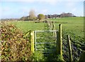
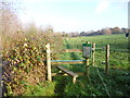
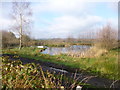
15 photos from this area
Area Information
Key information about the SP5 2AZ including its size, population, and administrative classification.
- Area Type
- Postcode
- Area Size
- 1.3 km²
- Population
- 1862
- Population Density
- 149 people/km²
House Prices in SP5 2AZ
60
Properties
£653,419
Average Sold Price
£153,500
Lowest Price
£1,530,000
Highest Price
Showing 60 properties
| Address | Type | Beds | Baths | Last Sale Price | Last Sale Date | |
|---|---|---|---|---|---|---|
| Mandarin House, New Road, Landford, SP5 2AZ | Detached | 4 | 2 | £700,000 | Jun 2024 | |
| Pine View, New Road, Landford, SP5 2AZ | Detached | 5 | 4 | £1,450,000 | Jun 2024 | |
| Whinchats, New Road, Landford, SP5 2AZ | Retail | 4 | 2 | £950,000 | Aug 2022 | |
| Forest Springs Farm, New Road, Landford, SP5 2AZ | house | - | - | £1,530,000 | Nov 2021 | |
| Furzecroft, New Road, Landford, SP5 2AZ | Lodge | 2 | 2 | £1,100,000 | Jan 2021 | |
| Heywood House, New Road, Landford, SP5 2AZ | Detached | 5 | 4 | £1,050,000 | Nov 2020 | |
| Bluebell Spring, New Road, Landford, SP5 2AZ | Detached | 4 | 2 | £1,100,000 | Feb 2018 | |
| Heatherlea Cottage, New Road, Landford, SP5 2AZ | Detached | 5 | 4 | £800,000 | Mar 2016 | |
| Laurel House, New Road, Landford, SP5 2AZ | Detached | 5 | - | £625,000 | Feb 2014 | |
| Old Wheelwrights, New Road, Landford, SP5 2AZ | house | 4 | - | £740,000 | Aug 2012 |
Page 1 of 6
Energy Efficiency in SP5 2AZ
Amenities
Schools
| Rank | School | Type | Entry gender | Ages |
|---|
Explore more schools in this area
Go to Schools tabDemographics
Household Size
Two person
most common
Accommodation Type
Houses
most common
Tenure
88
majority
Ethnic Group
White
most common
Religion
N/A
most common
Household Composition
N/A
most common
Age
47
median
Adults (30-64 years)
most common
Household Deprivation
N/A
with no deprivation
NS-SEC
46
in Lower managerial occupations
Explore more demographic insights in this area
Go to Demographics tabPlanning
Planning Constraints
- Flood RiskPremium
- Ramsar Wetland SitesPremium
- Area of Outstanding Natural BeautyPremium
- Protected Nature ReservePremium
- Protected WoodlandPremium