Area Overview for SP5 1AA
Photos of SP5 1AA
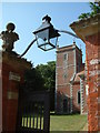
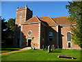
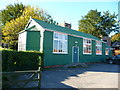
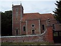
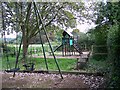
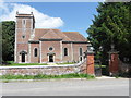
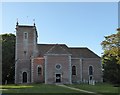
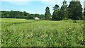
43 photos from this area
Area Information
Key information about the SP5 1AA including its size, population, and administrative classification.
- Area Type
- Postcode
- Area Size
- 8.1 hectares
- Population
- 1710
- Population Density
- 102 people/km²
House Prices in SP5 1AA
20
Properties
£470,665
Average Sold Price
£135,000
Lowest Price
£1,285,000
Highest Price
Showing 20 properties
| Address | Type | Beds | Baths | Last Sale Price | Last Sale Date | |
|---|---|---|---|---|---|---|
| 2, High Trees, The Street, Farley, SP5 1AA | Semi-detached | 2 | 1 | £300,000 | Jul 2024 | |
| Snowdrops, The Street, Farley, SP5 1AA | Detached | 4 | 1 | £590,000 | May 2024 | |
| Yew Tree Cottage, The Street, Farley, SP5 1AA | house | - | - | £790,000 | Jun 2021 | |
| Green Loaming, The Street, Farley, SP5 1AA | house | - | - | £1,285,000 | Feb 2021 | |
| Hope Cottage, The Street, Farley, SP5 1AA | Detached | 3 | 2 | £445,000 | Oct 2019 | |
| Sage Cottage, The Street, Farley, SP5 1AA | Bungalow | 4 | - | £439,950 | Sep 2015 | |
| 1, High Trees, The Street, Farley, SP5 1AA | Semi-detached | 2 | - | £200,000 | Oct 2013 | |
| Haddon Cottage, The Street, Farley, SP5 1AA | house | - | - | £581,000 | May 2013 | |
| Highfield, The Street, Farley, SP5 1AA | Bungalow | - | - | £430,000 | Nov 2012 | |
| Streetside, The Street, Farley, SP5 1AA | Bungalow | 2 | 1 | £250,000 | Jul 2010 |
Page 1 of 2
Energy Efficiency in SP5 1AA
Amenities
Schools
| Rank | School | Type | Entry gender | Ages |
|---|
Explore more schools in this area
Go to Schools tabDemographics
Household Size
Two person
most common
Accommodation Type
Houses
most common
Tenure
83
majority
Ethnic Group
White
most common
Religion
N/A
most common
Household Composition
N/A
most common
Age
47
median
Adults (30-64 years)
most common
Household Deprivation
N/A
with no deprivation
NS-SEC
45
in Lower managerial occupations
Explore more demographic insights in this area
Go to Demographics tabPlanning
Planning Constraints
- Flood RiskPremium
- Ramsar Wetland SitesPremium
- Area of Outstanding Natural BeautyPremium
- Protected Nature ReservePremium
- Protected WoodlandPremium