Area Overview for SP4 9SY
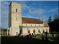
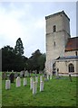
Photos of SP4 9SY
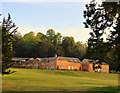

![Netheravon House [1] in SP4 9SY](https://images.propbar.co.uk/images/geograph/63/90/6390177_120.jpg)
![Netheravon House [2] in SP4 9SY](https://images.propbar.co.uk/images/geograph/63/90/6390179_120.jpg)
57 photos from this area
Area Information
Key information about the SP4 9SY including its size, population, and administrative classification.
- Area Type
- Postcode
- Area Size
- 8.9 hectares
- Population
- 1784
- Population Density
- 32 people/km²
House Prices in SP4 9SY
9
Properties
£655,444
Average Sold Price
£225,000
Lowest Price
£2,200,000
Highest Price
Showing 9 properties
| Address | Type | Beds | Baths | Last Sale Price | Last Sale Date | |
|---|---|---|---|---|---|---|
| 6, The Stables, Lower Road, Netheravon, SP4 9SY | Semi-detached | 3 | 3 | £546,500 | Aug 2023 | |
| Netheravon House, Lower Road, Netheravon, SP4 9SY | Semi-detached | 7 | 5 | £2,200,000 | Aug 2021 | |
| 5, The Stables, Lower Road, Netheravon, SP4 9SY | house | - | - | £410,000 | Apr 2021 | |
| 3, The Stables, Lower Road, Netheravon, SP4 9SY | Terraced | 4 | 3 | £495,000 | Oct 2020 | |
| 4, The Stables, Lower Road, Netheravon, SP4 9SY | Detached | 3 | 2 | £489,000 | Oct 2020 | |
| 1, The Stables, Lower Road, Netheravon, SP4 9SY | Terraced | 3 | 2 | £380,000 | Mar 2010 | |
| 7, The Stables, Lower Road, Netheravon, SP4 9SY | Cottage | 3 | 3 | £393,500 | Dec 2007 | |
| 2, The Stables, Lower Road, Netheravon, SP4 9SY | Terraced | 3 | 2 | £225,000 | Jan 2007 | |
| Cormayles, Lower Road, Netheravon, SP4 9SY | Semi-detached | - | - | £760,000 | Jun 2006 |
Energy Efficiency in SP4 9SY
Amenities
Schools
| Rank | School | Type | Entry gender | Ages |
|---|
Explore more schools in this area
Go to Schools tabDemographics
Household Size
Two person
most common
Accommodation Type
Houses
most common
Tenure
67
majority
Ethnic Group
White
most common
Religion
N/A
most common
Household Composition
N/A
most common
Age
47
median
Adults (30-64 years)
most common
Household Deprivation
N/A
with no deprivation
NS-SEC
37
in Lower managerial occupations
Explore more demographic insights in this area
Go to Demographics tabPlanning
Planning Constraints
- Flood RiskPremium
- Ramsar Wetland SitesPremium
- Area of Outstanding Natural BeautyPremium
- Protected Nature ReservePremium
- Protected WoodlandPremium