Area Overview for SP4 8HB
Photos of SP4 8HB


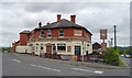
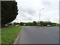


36 photos from this area
Area Information
Key information about the SP4 8HB including its size, population, and administrative classification.
- Area Type
- Postcode
- Area Size
- 2.3 hectares
- Population
- 1350
- Population Density
- 1683 people/km²
House Prices in SP4 8HB
29
Properties
£362,434
Average Sold Price
£80,000
Lowest Price
£725,000
Highest Price
Showing 29 properties
| Address | Type | Beds | Baths | Last Sale Price | Last Sale Date | |
|---|---|---|---|---|---|---|
| 192 Bulford Road, Durrington, SP4 8HB | Detached | 4 | - | £700,000 | May 2022 | |
| Orchard House, 192A Bulford Road, Durrington, SP4 8HB | Detached | 7 | 3 | £725,000 | Jun 2021 | |
| 193 Bulford Road, Durrington, SP4 8HB | Bungalow | 5 | 1 | £465,000 | Oct 2020 | |
| 210 Bulford Road, Durrington, SP4 8HB | Bungalow | 3 | 1 | £450,000 | Mar 2020 | |
| 203 Bulford Road, Durrington, SP4 8HB | Bungalow | - | - | £230,000 | Oct 2017 | |
| 191 Bulford Road, Durrington, SP4 8HB | house | - | - | £430,000 | Sep 2016 | |
| 196 Bulford Road, Durrington, SP4 8HB | Detached | 4 | - | £372,000 | Jun 2016 | |
| White Cottage, 194 Bulford Road, Durrington, SP4 8HB | Detached | 2 | 1 | £229,950 | Feb 2014 | |
| East End Manor, 212 Bulford Road, Durrington, SP4 8HB | house | 5 | - | £665,000 | Jan 2014 | |
| The Orchard, 214 Bulford Road, Durrington, SP4 8HB | Terraced | - | - | £330,000 | May 2009 |
Page 1 of 3
Energy Efficiency in SP4 8HB
Amenities
Schools
| Rank | School | Type | Entry gender | Ages |
|---|
Explore more schools in this area
Go to Schools tabDemographics
Household Size
Two person
most common
Accommodation Type
Houses
most common
Tenure
78
majority
Ethnic Group
White
most common
Religion
N/A
most common
Household Composition
N/A
most common
Age
47
median
Adults (30-64 years)
most common
Household Deprivation
N/A
with no deprivation
NS-SEC
38
in Lower managerial occupations
Explore more demographic insights in this area
Go to Demographics tabPlanning
Planning Constraints
- Flood RiskPremium
- Ramsar Wetland SitesPremium
- Area of Outstanding Natural BeautyPremium
- Protected Nature ReservePremium
- Protected WoodlandPremium