Area Overview for SP4 8DR
Photos of SP4 8DR
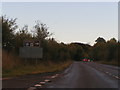
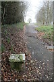
![Durrington Walls [1] in SP4 8DR](https://images.propbar.co.uk/images/geograph/63/90/6390252_120.jpg)
53 photos from this area
Area Information
Key information about the SP4 8DR including its size, population, and administrative classification.
- Area Type
- Postcode
- Area Size
- 1.4 hectares
- Population
- 1437
- Population Density
- 2174 people/km²
House Prices in SP4 8DR
16
Properties
£323,500
Average Sold Price
£63,500
Lowest Price
£580,000
Highest Price
Showing 16 properties
| Address | Type | Beds | Baths | Last Sale Price | Last Sale Date | |
|---|---|---|---|---|---|---|
| 21 Larkhill Road, Durrington, SP4 8DR | house | 3 | 1 | £327,000 | Jun 2025 | |
| Keepers End, Larkhill Road, Durrington, SP4 8DR | Detached | 4 | 3 | £580,000 | Dec 2021 | |
| 26 Larkhill Road, Durrington, SP4 8DR | house | - | - | £63,500 | Jan 1999 | |
| 15 Larkhill Road, Durrington, SP4 8DR | Detached | 3 | 1 | - | - | |
| 27 Larkhill Road, Durrington, SP4 8DR | house | - | - | - | - | |
| 24 Larkhill Road, Durrington, SP4 8DR | house | - | - | - | - | |
| 20 Larkhill Road, Durrington, SP4 8DR | house | - | - | - | - | |
| 25 Larkhill Road, Durrington, SP4 8DR | house | - | - | - | - | |
| 22 Larkhill Road, Durrington, SP4 8DR | house | - | - | - | - | |
| 19 Larkhill Road, Durrington, SP4 8DR | house | - | - | - | - |
Page 1 of 2
Energy Efficiency in SP4 8DR
Amenities
Schools
| Rank | School | Type | Entry gender | Ages |
|---|
Explore more schools in this area
Go to Schools tabDemographics
Household Size
Family (3-5 people)
most common
Accommodation Type
Houses
most common
Tenure
57
majority
Ethnic Group
White
most common
Religion
N/A
most common
Household Composition
N/A
most common
Age
47
median
Adults (30-64 years)
most common
Household Deprivation
N/A
with no deprivation
NS-SEC
24
in Lower managerial occupations
Explore more demographic insights in this area
Go to Demographics tabPlanning
Planning Constraints
- Flood RiskPremium
- Ramsar Wetland SitesPremium
- Area of Outstanding Natural BeautyPremium
- Protected Nature ReservePremium
- Protected WoodlandPremium