Area Overview for SP4 8AS
Photos of SP4 8AS

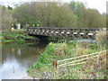
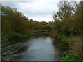

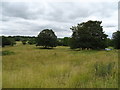
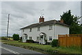

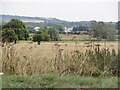
16 photos from this area
Area Information
Key information about the SP4 8AS including its size, population, and administrative classification.
- Area Type
- Postcode
- Area Size
- 18.8 hectares
- Population
- 2303
- Population Density
- 27 people/km²
House Prices in SP4 8AS
23
Properties
£436,700
Average Sold Price
£70,000
Lowest Price
£1,200,000
Highest Price
Showing 23 properties
| Address | Type | Beds | Baths | Last Sale Price | Last Sale Date | |
|---|---|---|---|---|---|---|
| Highbank, Hackthorne Road, Durrington, SP4 8AS | Bungalow | 3 | 1 | £455,000 | Aug 2024 | |
| Riverside Cottage, Hackthorne Road, Durrington, SP4 8AS | house | 3 | - | £750,000 | Nov 2022 | |
| Hackthorne House, Hackthorne Road, Durrington, SP4 8AS | Detached | 6 | 2 | £850,000 | Jan 2020 | |
| Field End, Hackthorne Road, Durrington, SP4 8AS | Detached | 5 | 2 | £585,000 | Jun 2019 | |
| Clifftop, Hackthorne Road, Durrington, SP4 8AS | Bungalow | 3 | 1 | £323,000 | Aug 2017 | |
| Langrod, Hackthorne Road, Durrington, SP4 8AS | Bungalow | 4 | - | £310,000 | Jul 2015 | |
| Amberwood, Hackthorne Road, Durrington, SP4 8AS | Detached | 3 | - | £250,000 | Jul 2014 | |
| West View, Hackthorne Road, Durrington, SP4 8AS | Detached | 4 | - | £370,800 | Aug 2013 | |
| Waters Edge, Hackthorne Road, Durrington, SP4 8AS | Detached | 4 | 4 | £1,200,000 | Apr 2013 | |
| White House, Hackthorne Road, Durrington, SP4 8AS | Detached | - | - | £280,000 | Oct 2008 |
Page 1 of 3
Energy Efficiency in SP4 8AS
Amenities
Schools
| Rank | School | Type | Entry gender | Ages |
|---|
Explore more schools in this area
Go to Schools tabDemographics
Household Size
Two person
most common
Accommodation Type
Houses
most common
Tenure
57
majority
Ethnic Group
White
most common
Religion
N/A
most common
Household Composition
N/A
most common
Age
47
median
Adults (30-64 years)
most common
Household Deprivation
N/A
with no deprivation
NS-SEC
39
in Lower managerial occupations
Explore more demographic insights in this area
Go to Demographics tabPlanning
Planning Constraints
- Flood RiskPremium
- Ramsar Wetland SitesPremium
- Area of Outstanding Natural BeautyPremium
- Protected Nature ReservePremium
- Protected WoodlandPremium