Area Overview for SP4 7YE
Photos of SP4 7YE
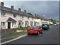
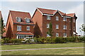
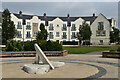
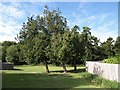
6 photos from this area
Area Information
Key information about the SP4 7YE including its size, population, and administrative classification.
- Area Type
- Postcode
- Area Size
- 1.6 hectares
- Population
- 1311
- Population Density
- 4616 people/km²
House Prices in SP4 7YE
49
Properties
£292,914
Average Sold Price
£84,000
Lowest Price
£450,000
Highest Price
Showing 49 properties
| Address | Type | Beds | Baths | Last Sale Price | Last Sale Date | |
|---|---|---|---|---|---|---|
| 78 Redworth Drive, Amesbury, SP4 7YE | house | - | - | £450,000 | Aug 2022 | |
| 84 Redworth Drive, Amesbury, SP4 7YE | house | 4 | 3 | £325,000 | Jun 2022 | |
| 4 Redworth Drive, Amesbury, SP4 7YE | Semi-detached | 3 | 2 | £265,000 | Jun 2021 | |
| 42 Redworth Drive, Amesbury, SP4 7YE | Detached | 3 | 2 | £285,000 | Apr 2021 | |
| 86 Redworth Drive, Amesbury, SP4 7YE | Terraced | 4 | - | £292,500 | Dec 2020 | |
| 76 Redworth Drive, Amesbury, SP4 7YE | Detached | 4 | 2 | £400,000 | Nov 2020 | |
| 88 Redworth Drive, Amesbury, SP4 7YE | house | 4 | - | £290,000 | Oct 2020 | |
| 98 Redworth Drive, Amesbury, SP4 7YE | Detached | 4 | - | £400,000 | Jan 2020 | |
| 60 Redworth Drive, Amesbury, SP4 7YE | Detached | 4 | 3 | £429,950 | Mar 2019 | |
| 92 Redworth Drive, Amesbury, SP4 7YE | Detached | 4 | 3 | £362,000 | Aug 2018 |
Page 1 of 5
Energy Efficiency in SP4 7YE
Amenities
Schools
| Rank | School | Type | Entry gender | Ages |
|---|
Explore more schools in this area
Go to Schools tabDemographics
Household Size
Family (3-5 people)
most common
Accommodation Type
Houses
most common
Tenure
57
majority
Ethnic Group
White
most common
Religion
N/A
most common
Household Composition
N/A
most common
Age
47
median
Adults (30-64 years)
most common
Household Deprivation
N/A
with no deprivation
NS-SEC
40
in Lower managerial occupations
Explore more demographic insights in this area
Go to Demographics tabPlanning
Planning Constraints
- Flood RiskPremium
- Ramsar Wetland SitesPremium
- Area of Outstanding Natural BeautyPremium
- Protected Nature ReservePremium
- Protected WoodlandPremium