Area Overview for SP4 6BT
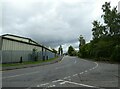
Photos of SP4 6BT
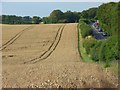
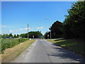
![Beehive park and ride [1] in SP4 6BT](https://images.propbar.co.uk/images/geograph/63/90/6390662_120.jpg)
25 photos from this area
Area Information
Key information about the SP4 6BT including its size, population, and administrative classification.
- Area Type
- Postcode
- Area Size
- 1.4 hectares
- Population
- 1485
- Population Density
- 1492 people/km²
House Prices in SP4 6BT
2
Properties
-
Average Sold Price
-
Lowest Price
-
Highest Price
Showing 2 properties
| Address | Type | Beds | Baths | Last Sale Price | Last Sale Date | |
|---|---|---|---|---|---|---|
| Sarum House, Portway, Old Sarum, SP4 6BT | Retirement | - | - | - | - | |
| Bradbury House, Portway, Old Sarum, SP4 6BT | office_workshop | - | - | - | - |
Energy Efficiency in SP4 6BT
Amenities
Schools
| Rank | School | Type | Entry gender | Ages |
|---|
Explore more schools in this area
Go to Schools tabDemographics
Household Size
Family (3-5 people)
most common
Accommodation Type
Houses
most common
Tenure
44
majority
Ethnic Group
White
most common
Religion
N/A
most common
Household Composition
N/A
most common
Age
47
median
Adults (30-64 years)
most common
Household Deprivation
N/A
with no deprivation
NS-SEC
34
in Lower managerial occupations
Explore more demographic insights in this area
Go to Demographics tabPlanning
Planning Constraints
- Flood RiskPremium
- Ramsar Wetland SitesPremium
- Area of Outstanding Natural BeautyPremium
- Protected Nature ReservePremium
- Protected WoodlandPremium