Area Overview for SP2 9NQ
Photos of SP2 9NQ


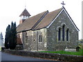


100 photos from this area
Area Information
Key information about the SP2 9NQ including its size, population, and administrative classification.
- Area Type
- Postcode
- Area Size
- 1.7 hectares
- Population
- 1471
- Population Density
- 2174 people/km²
House Prices in SP2 9NQ
13
Properties
£432,286
Average Sold Price
£151,000
Lowest Price
£1,080,000
Highest Price
Showing 13 properties
| Address | Type | Beds | Baths | Last Sale Price | Last Sale Date | |
|---|---|---|---|---|---|---|
| 44 Lower Road, Salisbury, SP2 9NQ | Terraced | 3 | 1 | £315,000 | Jan 2025 | |
| 50 Lower Road, Salisbury, SP2 9NQ | Detached | 7 | 5 | £357,500 | Mar 2023 | |
| 76 Lower Road, Salisbury, SP2 9NQ | Detached | 3 | 2 | £595,000 | Jul 2022 | |
| 48 Lower Road, Salisbury, SP2 9NQ | house | - | - | £282,500 | Oct 2020 | |
| 54 Lower Road, Salisbury, SP2 9NQ | Detached | 5 | - | £1,080,000 | Nov 2013 | |
| 46 Lower Road, Salisbury, SP2 9NQ | Terraced | - | - | £151,000 | Jul 2002 | |
| 74 Lower Road, Salisbury, SP2 9NQ | Terraced | - | - | £245,000 | Aug 2000 | |
| Nadder House, Lower Road, Salisbury, SP2 9NQ | Detached | 7 | 5 | - | - | |
| Nadder Barn, Lower Road, Salisbury, SP2 9NQ | house | - | - | - | - | |
| 42 Lower Road, Salisbury, SP2 9NQ | Terraced | - | - | - | - |
Page 1 of 2
Energy Efficiency in SP2 9NQ
Amenities
Schools
| Rank | School | Type | Entry gender | Ages |
|---|
Explore more schools in this area
Go to Schools tabDemographics
Household Size
Two person
most common
Accommodation Type
Houses
most common
Tenure
79
majority
Ethnic Group
White
most common
Religion
N/A
most common
Household Composition
N/A
most common
Age
47
median
Adults (30-64 years)
most common
Household Deprivation
N/A
with no deprivation
NS-SEC
39
in Lower managerial occupations
Explore more demographic insights in this area
Go to Demographics tabPlanning
Planning Constraints
- Flood RiskPremium
- Ramsar Wetland SitesPremium
- Area of Outstanding Natural BeautyPremium
- Protected Nature ReservePremium
- Protected WoodlandPremium