Area Overview for SP2 9GA
Photos of SP2 9GA
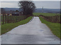
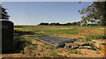

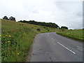
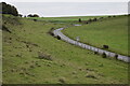
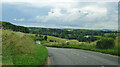
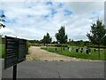
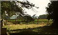
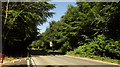
13 photos from this area
Area Information
Key information about the SP2 9GA including its size, population, and administrative classification.
- Area Type
- Postcode
- Area Size
- 9376 m²
- Population
- 2685
- Population Density
- 2043 people/km²
House Prices in SP2 9GA
36
Properties
£277,350
Average Sold Price
£232,000
Lowest Price
£344,995
Highest Price
Showing 36 properties
| Address | Type | Beds | Baths | Last Sale Price | Last Sale Date | |
|---|---|---|---|---|---|---|
| 53 Longspee Lane, Salisbury, SP2 9GA | Terraced | 2 | 1 | £255,000 | Jul 2025 | |
| 49 Longspee Lane, Salisbury, SP2 9GA | house | - | - | £265,000 | Mar 2025 | |
| 17 Longspee Lane, Salisbury, SP2 9GA | Terraced | 2 | - | £245,000 | Jun 2024 | |
| 1 Longspee Lane, Salisbury, SP2 9GA | house | - | - | £344,995 | Nov 2022 | |
| 3 Longspee Lane, Salisbury, SP2 9GA | house | - | - | £332,995 | Apr 2022 | |
| 8 Longspee Lane, Salisbury, SP2 9GA | house | - | - | £244,995 | Mar 2022 | |
| 10 Longspee Lane, Salisbury, SP2 9GA | house | - | - | £244,995 | Mar 2022 | |
| 21 Longspee Lane, Salisbury, SP2 9GA | house | - | - | £267,995 | Dec 2021 | |
| 23 Longspee Lane, Salisbury, SP2 9GA | house | - | - | £232,000 | Dec 2021 | |
| 15 Longspee Lane, Salisbury, SP2 9GA | house | - | - | £315,240 | Aug 2021 |
Page 1 of 4
Energy Efficiency in SP2 9GA
Amenities
Schools
| Rank | School | Type | Entry gender | Ages |
|---|
Explore more schools in this area
Go to Schools tabDemographics
Household Size
Family (3-5 people)
most common
Accommodation Type
Houses
most common
Tenure
65
majority
Ethnic Group
White
most common
Religion
N/A
most common
Household Composition
N/A
most common
Age
47
median
Adults (30-64 years)
most common
Household Deprivation
N/A
with no deprivation
NS-SEC
34
in Lower managerial occupations
Explore more demographic insights in this area
Go to Demographics tabPlanning
Planning Constraints
- Flood RiskPremium
- Ramsar Wetland SitesPremium
- Area of Outstanding Natural BeautyPremium
- Protected Nature ReservePremium
- Protected WoodlandPremium