Area Overview for SP2 9EY
Photos of SP2 9EY


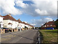
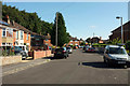
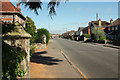

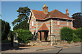
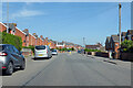

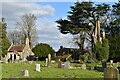
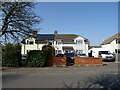

46 photos from this area
Area Information
Key information about the SP2 9EY including its size, population, and administrative classification.
- Area Type
- Postcode
- Area Size
- 1.1 hectares
- Population
- 1945
- Population Density
- 6455 people/km²
House Prices in SP2 9EY
31
Properties
£121,096
Average Sold Price
£50,000
Lowest Price
£225,000
Highest Price
Showing 31 properties
| Address | Type | Beds | Baths | Last Sale Price | Last Sale Date | |
|---|---|---|---|---|---|---|
| 18 Glyndebourne Close, Bemerton Heath, Salisbury, SP2 9EY | house | 3 | - | £225,000 | Feb 2023 | |
| 8 Glyndebourne Close, Bemerton Heath, Salisbury, SP2 9EY | house | - | - | £200,000 | Mar 2022 | |
| 30 Glyndebourne Close, Bemerton Heath, Salisbury, SP2 9EY | house | - | - | £217,500 | Dec 2020 | |
| 6 Glyndebourne Close, Bemerton Heath, Salisbury, SP2 9EY | Terraced | 2 | 1 | £158,000 | Dec 2019 | |
| 26 Glyndebourne Close, Bemerton Heath, Salisbury, SP2 9EY | Terraced | 3 | - | £158,500 | Jun 2014 | |
| 34 Glyndebourne Close, Bemerton Heath, Salisbury, SP2 9EY | house | 3 | - | £144,000 | Nov 2013 | |
| 54 Glyndebourne Close, Bemerton Heath, Salisbury, SP2 9EY | house | - | - | £145,000 | Jun 2007 | |
| 60 Glyndebourne Close, Bemerton Heath, Salisbury, SP2 9EY | Terraced | - | - | £50,000 | Oct 2001 | |
| 46 Glyndebourne Close, Bemerton Heath, Salisbury, SP2 9EY | house | - | - | £78,000 | Aug 2000 | |
| 48 Glyndebourne Close, Bemerton Heath, Salisbury, SP2 9EY | house | - | - | £68,000 | Sep 1999 |
Page 1 of 4
Energy Efficiency in SP2 9EY
Amenities
Schools
| Rank | School | Type | Entry gender | Ages |
|---|
Explore more schools in this area
Go to Schools tabDemographics
Household Size
Family (3-5 people)
most common
Accommodation Type
Houses
most common
Tenure
36
majority
Ethnic Group
White
most common
Religion
N/A
most common
Household Composition
N/A
most common
Age
47
median
Adults (30-64 years)
most common
Household Deprivation
N/A
with no deprivation
NS-SEC
22
in Lower managerial occupations
Explore more demographic insights in this area
Go to Demographics tabPlanning
Planning Constraints
- Flood RiskPremium
- Ramsar Wetland SitesPremium
- Area of Outstanding Natural BeautyPremium
- Protected Nature ReservePremium
- Protected WoodlandPremium