Area Overview for SP2 9AR
Photos of SP2 9AR
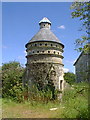
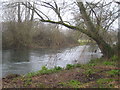
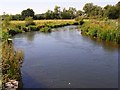
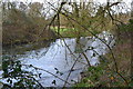
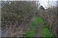
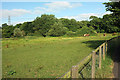
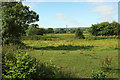
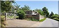
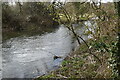
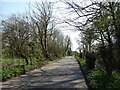
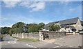
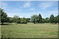
17 photos from this area
Area Information
Key information about the SP2 9AR including its size, population, and administrative classification.
- Area Type
- Postcode
- Area Size
- 49.8 hectares
- Population
- 1402
- Population Density
- 100 people/km²
House Prices in SP2 9AR
26
Properties
£403,389
Average Sold Price
£120,000
Lowest Price
£845,000
Highest Price
Showing 26 properties
| Address | Type | Beds | Baths | Last Sale Price | Last Sale Date | |
|---|---|---|---|---|---|---|
| Melbourne, Lower Road, Quidhampton, SP2 9AR | Semi-detached | 4 | 1 | £389,000 | Aug 2022 | |
| Still Waters, Lower Road, Quidhampton, SP2 9AR | house | - | - | £845,000 | Sep 2021 | |
| Wellington, Lower Road, Quidhampton, SP2 9AR | house | - | - | £425,000 | Jun 2021 | |
| Meadow Glen, Lower Road, Quidhampton, SP2 9AR | Bungalow | - | - | £450,000 | Oct 2020 | |
| Tall Trees, Lower Road, Quidhampton, SP2 9AR | Detached | 3 | 1 | £345,000 | Jul 2018 | |
| Tara, Lower Road, Quidhampton, SP2 9AR | house | 4 | - | £500,000 | Sep 2017 | |
| Tinkerpit, Lower Road, Quidhampton, SP2 9AR | house | - | - | £375,000 | Aug 2017 | |
| Broadstone, Lower Road, Quidhampton, SP2 9AR | house | - | - | £392,500 | Feb 2017 | |
| Forest View, Lower Road, Quidhampton, SP2 9AR | Detached | 4 | 4 | £445,000 | Sep 2016 | |
| Groveley Dene, Lower Road, Quidhampton, SP2 9AR | Semi-detached | 4 | - | £315,000 | Oct 2013 |
Page 1 of 3
Energy Efficiency in SP2 9AR
Amenities
Schools
| Rank | School | Type | Entry gender | Ages |
|---|
Explore more schools in this area
Go to Schools tabDemographics
Household Size
Two person
most common
Accommodation Type
Houses
most common
Tenure
61
majority
Ethnic Group
White
most common
Religion
N/A
most common
Household Composition
N/A
most common
Age
47
median
Adults (30-64 years)
most common
Household Deprivation
N/A
with no deprivation
NS-SEC
30
in Lower managerial occupations
Explore more demographic insights in this area
Go to Demographics tabPlanning
Planning Constraints
- Flood RiskPremium
- Ramsar Wetland SitesPremium
- Area of Outstanding Natural BeautyPremium
- Protected Nature ReservePremium
- Protected WoodlandPremium