Area Overview for SP2 0QW
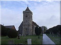
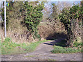
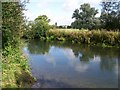
Photos of SP2 0QW
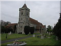

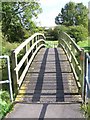

![South Newton houses [1] in SP2 0QW](https://images.propbar.co.uk/images/geograph/71/81/7181525_120.jpg)
50 photos from this area
Area Information
Key information about the SP2 0QW including its size, population, and administrative classification.
- Area Type
- Postcode
- Area Size
- 36.5 hectares
- Population
- 2031
- Population Density
- 38 people/km²
House Prices in SP2 0QW
33
Properties
£411,972
Average Sold Price
£48,500
Lowest Price
£600,000
Highest Price
Showing 33 properties
| Address | Type | Beds | Baths | Last Sale Price | Last Sale Date | |
|---|---|---|---|---|---|---|
| Harfield, Warminster Road, South Newton, SP2 0QW | house | 4 | 2 | £568,000 | Mar 2025 | |
| Timberlea, Warminster Road, South Newton, SP2 0QW | Detached | 5 | 4 | £597,500 | Jul 2024 | |
| Swanmead, Warminster Road, South Newton, SP2 0QW | house | 4 | 2 | £495,000 | May 2024 | |
| Marjan House, Warminster Road, South Newton, SP2 0QW | Detached | 3 | 2 | £600,000 | Dec 2023 | |
| Beech Grove, Warminster Road, South Newton, SP2 0QW | house | - | - | £480,000 | May 2023 | |
| Fairview, Warminster Road, South Newton, SP2 0QW | house | 3 | - | £368,500 | Apr 2022 | |
| Willow Down, Warminster Road, South Newton, SP2 0QW | Detached | 4 | 2 | £503,000 | Nov 2020 | |
| Tehran, Warminster Road, South Newton, SP2 0QW | Detached | 3 | 2 | £450,000 | Oct 2017 | |
| Hawarden, Warminster Road, South Newton, SP2 0QW | Bungalow | - | - | £357,500 | May 2017 | |
| Bonham Lodge, Warminster Road, South Newton, SP2 0QW | Detached | 4 | - | £360,000 | Jan 2016 |
Page 1 of 4
Energy Efficiency in SP2 0QW
Amenities
Schools
| Rank | School | Type | Entry gender | Ages |
|---|
Explore more schools in this area
Go to Schools tabDemographics
Household Size
Two person
most common
Accommodation Type
Houses
most common
Tenure
60
majority
Ethnic Group
White
most common
Religion
N/A
most common
Household Composition
N/A
most common
Age
47
median
Adults (30-64 years)
most common
Household Deprivation
N/A
with no deprivation
NS-SEC
37
in Lower managerial occupations
Explore more demographic insights in this area
Go to Demographics tabPlanning
Planning Constraints
- Flood RiskPremium
- Ramsar Wetland SitesPremium
- Area of Outstanding Natural BeautyPremium
- Protected Nature ReservePremium
- Protected WoodlandPremium