Area Overview for SP2 0NN
Photos of SP2 0NN
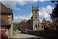

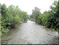
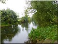
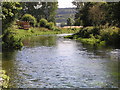
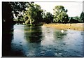
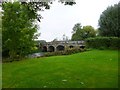
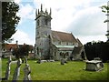
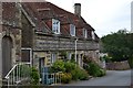
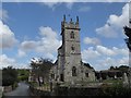
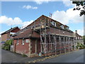
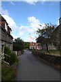
89 photos from this area
Area Information
Key information about the SP2 0NN including its size, population, and administrative classification.
- Area Type
- Postcode
- Area Size
- 5.8 hectares
- Population
- 2031
- Population Density
- 38 people/km²
House Prices in SP2 0NN
30
Properties
£441,765
Average Sold Price
£152,000
Lowest Price
£1,487,380
Highest Price
Showing 30 properties
| Address | Type | Beds | Baths | Last Sale Price | Last Sale Date | |
|---|---|---|---|---|---|---|
| Beehive House, South Street, Great Wishford, SP2 0NN | Detached | 3 | 1 | £687,500 | Aug 2025 | |
| Evergreen Cottage, South Street, Great Wishford, SP2 0NN | Cottage | 3 | 1 | £585,000 | May 2025 | |
| The Bakery, South Street, Great Wishford, SP2 0NN | Cottage | 3 | 1 | £230,000 | Aug 2024 | |
| Yew Tree Cottage, South Street, Great Wishford, SP2 0NN | Detached | 4 | 2 | £615,000 | Jul 2024 | |
| 1, Rectory Cottage, South Street, Great Wishford, SP2 0NN | house | 2 | 1 | £255,000 | Nov 2023 | |
| Cobb Cottage, South Street, Great Wishford, SP2 0NN | Semi-detached | 2 | 1 | £312,500 | Jun 2023 | |
| Violet Cottage, South Street, Great Wishford, SP2 0NN | Detached | 2 | 2 | £152,000 | Jun 2023 | |
| The Old Rectory, South Street, Great Wishford, SP2 0NN | Detached | 6 | 4 | £1,487,380 | Mar 2019 | |
| Oban's Folly, South Street, Great Wishford, SP2 0NN | Detached | 3 | 2 | £297,100 | Jun 2017 | |
| The Cottage, South Street, Great Wishford, SP2 0NN | Detached | 4 | 3 | £430,000 | Oct 2015 |
Page 1 of 3
Energy Efficiency in SP2 0NN
Amenities
Schools
| Rank | School | Type | Entry gender | Ages |
|---|
Explore more schools in this area
Go to Schools tabDemographics
Household Size
Two person
most common
Accommodation Type
Houses
most common
Tenure
60
majority
Ethnic Group
White
most common
Religion
N/A
most common
Household Composition
N/A
most common
Age
47
median
Adults (30-64 years)
most common
Household Deprivation
N/A
with no deprivation
NS-SEC
37
in Lower managerial occupations
Explore more demographic insights in this area
Go to Demographics tabPlanning
Planning Constraints
- Flood RiskPremium
- Ramsar Wetland SitesPremium
- Area of Outstanding Natural BeautyPremium
- Protected Nature ReservePremium
- Protected WoodlandPremium