Area Overview for SP2 0LW
Photos of SP2 0LW
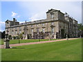
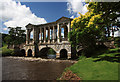

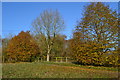
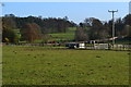
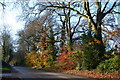
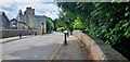
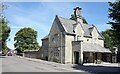
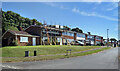

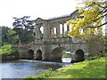
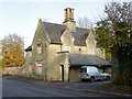
42 photos from this area
Area Information
Key information about the SP2 0LW including its size, population, and administrative classification.
- Area Type
- Postcode
- Area Size
- 1.3 hectares
- Population
- 1322
- Population Density
- 556 people/km²
House Prices in SP2 0LW
26
Properties
£219,090
Average Sold Price
£69,000
Lowest Price
£378,000
Highest Price
Showing 26 properties
| Address | Type | Beds | Baths | Last Sale Price | Last Sale Date | |
|---|---|---|---|---|---|---|
| 3 Wessex Road, Wilton, SP2 0LW | Bungalow | 2 | 1 | £378,000 | Mar 2022 | |
| 5 Wessex Road, Wilton, SP2 0LW | Bungalow | - | - | £280,000 | Aug 2017 | |
| 7 Wessex Road, Wilton, SP2 0LW | Bungalow | - | - | £290,000 | Apr 2017 | |
| 23 Wessex Road, Wilton, SP2 0LW | Bungalow | - | - | £247,000 | Jan 2014 | |
| 22 Wessex Road, Wilton, SP2 0LW | Bungalow | 2 | - | £270,000 | Dec 2013 | |
| 11 Wessex Road, Wilton, SP2 0LW | Detached | - | - | £245,000 | Sep 2013 | |
| 12 Wessex Road, Wilton, SP2 0LW | Bungalow | 3 | 1 | £250,000 | Sep 2013 | |
| 18 Wessex Road, Wilton, SP2 0LW | Bungalow | - | - | £177,950 | Sep 2010 | |
| 19 Wessex Road, Wilton, SP2 0LW | Detached | - | - | £239,950 | Dec 2007 | |
| 1 Wessex Road, Wilton, SP2 0LW | Bungalow | 3 | - | £240,000 | Nov 2005 |
Page 1 of 3
Energy Efficiency in SP2 0LW
Amenities
Schools
| Rank | School | Type | Entry gender | Ages |
|---|
Explore more schools in this area
Go to Schools tabDemographics
Household Size
Two person
most common
Accommodation Type
Houses
most common
Tenure
68
majority
Ethnic Group
White
most common
Religion
N/A
most common
Household Composition
N/A
most common
Age
47
median
Adults (30-64 years)
most common
Household Deprivation
N/A
with no deprivation
NS-SEC
42
in Lower managerial occupations
Explore more demographic insights in this area
Go to Demographics tabPlanning
Planning Constraints
- Flood RiskPremium
- Ramsar Wetland SitesPremium
- Area of Outstanding Natural BeautyPremium
- Protected Nature ReservePremium
- Protected WoodlandPremium