Area Overview for SP2 0HE
Photos of SP2 0HE
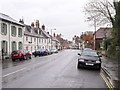
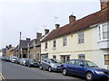

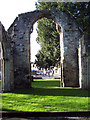
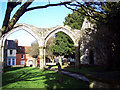
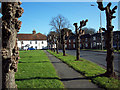
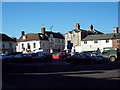

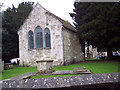
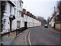

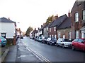
100 photos from this area
Area Information
Key information about the SP2 0HE including its size, population, and administrative classification.
- Area Type
- Postcode
- Area Size
- 8739 m²
- Population
- 2113
- Population Density
- 930 people/km²
House Prices in SP2 0HE
46
Properties
£214,937
Average Sold Price
£91,995
Lowest Price
£380,000
Highest Price
Showing 46 properties
| Address | Type | Beds | Baths | Last Sale Price | Last Sale Date | |
|---|---|---|---|---|---|---|
| 2 North Street, Wilton, SP2 0HE | house | 2 | 1 | £91,995 | Oct 2025 | |
| 18 North Street, Wilton, SP2 0HE | Terraced | 3 | 2 | £380,000 | May 2025 | |
| 37 North Street, Wilton, SP2 0HE | Cottage | 2 | 1 | £229,500 | Dec 2024 | |
| 4 North Street, Wilton, SP2 0HE | office_workshop | - | - | £107,000 | Oct 2022 | |
| 33 North Street, Wilton, SP2 0HE | Detached | 2 | 2 | £255,000 | Oct 2021 | |
| 31 North Street, Wilton, SP2 0HE | Semi-detached | 3 | 1 | £180,000 | Feb 2007 | |
| 25 North Street, Wilton, SP2 0HE | Terraced | - | - | £240,000 | Aug 2004 | |
| 39 North Street, Wilton, SP2 0HE | Terraced | - | - | £236,000 | Jun 2000 | |
| 49 NORTH STREET, Wilton, SP2 0HE | Terraced | - | - | - | - | |
| Flat B, 45 North Street, Wilton, SP2 0HE | Flat | - | - | - | - |
Page 1 of 5
Energy Efficiency in SP2 0HE
Amenities
Schools
| Rank | School | Type | Entry gender | Ages |
|---|
Explore more schools in this area
Go to Schools tabDemographics
Household Size
One person
most common
Accommodation Type
Houses
most common
Tenure
60
majority
Ethnic Group
White
most common
Religion
N/A
most common
Household Composition
N/A
most common
Age
47
median
Adults (30-64 years)
most common
Household Deprivation
N/A
with no deprivation
NS-SEC
41
in Lower managerial occupations
Explore more demographic insights in this area
Go to Demographics tabPlanning
Planning Constraints
- Flood RiskPremium
- Ramsar Wetland SitesPremium
- Area of Outstanding Natural BeautyPremium
- Protected Nature ReservePremium
- Protected WoodlandPremium