Area Overview for SP11 9RX
Photos of SP11 9RX
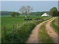
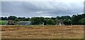
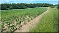
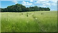
5 photos from this area
Area Information
Key information about the SP11 9RX including its size, population, and administrative classification.
- Area Type
- Postcode
- Area Size
- 8.0 hectares
- Population
- 1573
- Population Density
- 774 people/km²
House Prices in SP11 9RX
37
Properties
£180,809
Average Sold Price
£57,000
Lowest Price
£300,000
Highest Price
Showing 37 properties
| Address | Type | Beds | Baths | Last Sale Price | Last Sale Date | |
|---|---|---|---|---|---|---|
| 17 Old Common Way, Ludgershall, SP11 9RX | house | 3 | 1 | £300,000 | Jul 2024 | |
| 8 Old Common Way, Ludgershall, SP11 9RX | house | - | - | £199,950 | Oct 2023 | |
| 2 Old Common Way, Ludgershall, SP11 9RX | house | 3 | - | £300,000 | Oct 2022 | |
| 13 Old Common Way, Ludgershall, SP11 9RX | house | - | - | £220,000 | Jun 2020 | |
| 1 Old Common Way, Ludgershall, SP11 9RX | house | - | - | £165,000 | Aug 2013 | |
| 11 Old Common Way, Ludgershall, SP11 9RX | Semi-detached | 3 | - | £162,000 | Feb 2013 | |
| 10 Old Common Way, Ludgershall, SP11 9RX | house | - | - | £135,000 | Dec 2012 | |
| 15 Old Common Way, Ludgershall, SP11 9RX | Semi-detached | - | - | £156,000 | Oct 2005 | |
| 4 Old Common Way, Ludgershall, SP11 9RX | Semi-detached | - | - | £144,000 | Jul 2005 | |
| 26 Old Common Way, Ludgershall, SP11 9RX | house | - | - | £149,950 | Mar 2004 |
Page 1 of 4
Energy Efficiency in SP11 9RX
Amenities
Schools
| Rank | School | Type | Entry gender | Ages |
|---|
Explore more schools in this area
Go to Schools tabDemographics
Household Size
One person
most common
Accommodation Type
Houses
most common
Tenure
45
majority
Ethnic Group
White
most common
Religion
N/A
most common
Household Composition
N/A
most common
Age
47
median
Adults (30-64 years)
most common
Household Deprivation
N/A
with no deprivation
NS-SEC
24
in Lower managerial occupations
Explore more demographic insights in this area
Go to Demographics tabPlanning
Planning Constraints
- Flood RiskPremium
- Ramsar Wetland SitesPremium
- Area of Outstanding Natural BeautyPremium
- Protected Nature ReservePremium
- Protected WoodlandPremium