Area Overview for SP1 3PW
Photos of SP1 3PW
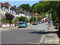
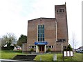
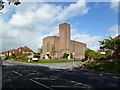
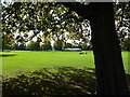
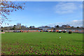
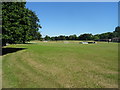
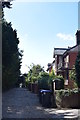
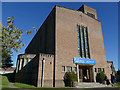
52 photos from this area
Area Information
Key information about the SP1 3PW including its size, population, and administrative classification.
- Area Type
- Postcode
- Area Size
- 1.5 hectares
- Population
- 1508
- Population Density
- 3446 people/km²
House Prices in SP1 3PW
31
Properties
£272,980
Average Sold Price
£83,500
Lowest Price
£487,000
Highest Price
Showing 31 properties
| Address | Type | Beds | Baths | Last Sale Price | Last Sale Date | |
|---|---|---|---|---|---|---|
| 34 Beatrice Road, Salisbury, SP1 3PW | house | 3 | - | £445,000 | Nov 2022 | |
| 39 Beatrice Road, Salisbury, SP1 3PW | house | - | - | £360,000 | Mar 2021 | |
| 45 Beatrice Road, Salisbury, SP1 3PW | Semi-detached | 4 | 2 | £410,000 | May 2019 | |
| 51 Beatrice Road, Salisbury, SP1 3PW | Detached | 3 | - | £487,000 | Apr 2018 | |
| 31 Beatrice Road, Salisbury, SP1 3PW | house | - | - | £285,000 | Aug 2013 | |
| 28 Beatrice Road, Salisbury, SP1 3PW | house | - | - | £265,000 | Feb 2012 | |
| 26 Beatrice Road, Salisbury, SP1 3PW | house | 3 | - | £280,000 | Oct 2010 | |
| 43 Beatrice Road, Salisbury, SP1 3PW | house | - | - | £246,175 | Oct 2009 | |
| 35 Beatrice Road, Salisbury, SP1 3PW | house | - | - | £230,000 | Jun 2009 | |
| 19 Beatrice Road, Salisbury, SP1 3PW | Semi-detached | - | - | £270,000 | Oct 2007 |
Page 1 of 4
Energy Efficiency in SP1 3PW
Amenities
Schools
| Rank | School | Type | Entry gender | Ages |
|---|
Explore more schools in this area
Go to Schools tabDemographics
Household Size
Two person
most common
Accommodation Type
Houses
most common
Tenure
91
majority
Ethnic Group
White
most common
Religion
N/A
most common
Household Composition
N/A
most common
Age
47
median
Adults (30-64 years)
most common
Household Deprivation
N/A
with no deprivation
NS-SEC
47
in Lower managerial occupations
Explore more demographic insights in this area
Go to Demographics tabPlanning
Planning Constraints
- Flood RiskPremium
- Ramsar Wetland SitesPremium
- Area of Outstanding Natural BeautyPremium
- Protected Nature ReservePremium
- Protected WoodlandPremium