Area Overview for SP1 3NX
Photos of SP1 3NX
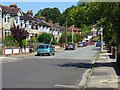
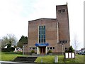
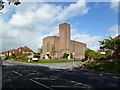
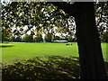
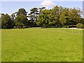
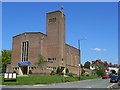
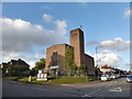
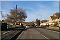
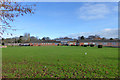
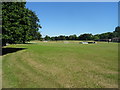
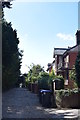
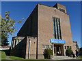
52 photos from this area
Area Information
Key information about the SP1 3NX including its size, population, and administrative classification.
- Area Type
- Postcode
- Area Size
- 1.4 hectares
- Population
- 1432
- Population Density
- 2529 people/km²
House Prices in SP1 3NX
40
Properties
£219,600
Average Sold Price
£30,000
Lowest Price
£385,000
Highest Price
Showing 40 properties
| Address | Type | Beds | Baths | Last Sale Price | Last Sale Date | |
|---|---|---|---|---|---|---|
| 72 Waters Road, Salisbury, SP1 3NX | Semi-detached | 3 | 2 | £385,000 | Jun 2025 | |
| 2 Waters Road, Salisbury, SP1 3NX | Semi-detached | 3 | 1 | £286,000 | Jul 2023 | |
| 78 Waters Road, Salisbury, SP1 3NX | house | - | - | £360,000 | Nov 2021 | |
| 16 Waters Road, Salisbury, SP1 3NX | Semi-detached | 3 | 1 | £216,000 | Jul 2017 | |
| 30 Waters Road, Salisbury, SP1 3NX | house | - | - | £207,000 | Jan 2016 | |
| 6 Waters Road, Salisbury, SP1 3NX | house | - | - | £215,000 | Nov 2013 | |
| 18 Waters Road, Salisbury, SP1 3NX | house | - | - | £182,000 | Mar 2011 | |
| 4 Waters Road, Salisbury, SP1 3NX | Semi-detached | - | - | £155,000 | May 2009 | |
| 12 Waters Road, Salisbury, SP1 3NX | Semi-detached | - | - | £160,000 | Dec 2003 | |
| 34 Waters Road, Salisbury, SP1 3NX | house | - | - | £30,000 | May 2000 |
Page 1 of 4
Energy Efficiency in SP1 3NX
Amenities
Schools
| Rank | School | Type | Entry gender | Ages |
|---|
Explore more schools in this area
Go to Schools tabDemographics
Household Size
One person
most common
Accommodation Type
Houses
most common
Tenure
54
majority
Ethnic Group
White
most common
Religion
N/A
most common
Household Composition
N/A
most common
Age
47
median
Adults (30-64 years)
most common
Household Deprivation
N/A
with no deprivation
NS-SEC
33
in Lower managerial occupations
Explore more demographic insights in this area
Go to Demographics tabPlanning
Planning Constraints
- Flood RiskPremium
- Ramsar Wetland SitesPremium
- Area of Outstanding Natural BeautyPremium
- Protected Nature ReservePremium
- Protected WoodlandPremium