Area Overview for SP1 3LB
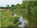
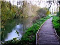
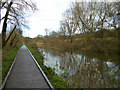
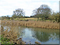
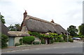
Photos of SP1 3LB
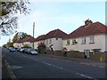

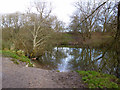

![Stratford-sub-Castle houses [8] in SP1 3LB](https://images.propbar.co.uk/images/geograph/61/53/6153456_120.jpg)
![Stratford-sub-Castle houses [10] in SP1 3LB](https://images.propbar.co.uk/images/geograph/61/53/6153458_120.jpg)
![Stratford-sub-Castle houses [11] in SP1 3LB](https://images.propbar.co.uk/images/geograph/61/53/6153459_120.jpg)
49 photos from this area
Area Information
Key information about the SP1 3LB including its size, population, and administrative classification.
- Area Type
- Postcode
- Area Size
- 2.3 hectares
- Population
- 1583
- Population Density
- 460 people/km²
House Prices in SP1 3LB
15
Properties
£319,325
Average Sold Price
£87,000
Lowest Price
£685,000
Highest Price
Showing 15 properties
| Address | Type | Beds | Baths | Last Sale Price | Last Sale Date | |
|---|---|---|---|---|---|---|
| Castle Cottage, Stratford Road, Stratford Sub Castle, SP1 3LB | Detached | 3 | 1 | £345,000 | Mar 2021 | |
| Kingsbridge Mead, Stratford Road, Stratford Sub Castle, SP1 3LB | Detached | 6 | - | £685,000 | Oct 2014 | |
| Cherry Grove, Stratford Road, Stratford Sub Castle, SP1 3LB | Detached | 4 | - | £415,000 | May 2013 | |
| The Old Laundry, Stratford Road, Stratford Sub Castle, SP1 3LB | Detached | 3 | 1 | £225,000 | Dec 2012 | |
| Golden Acre, Stratford Road, Stratford Sub Castle, SP1 3LB | house | - | - | £250,000 | Feb 2011 | |
| High Gables, The Portway, Stratford Sub Castle, SP1 3LB | house | - | - | £445,000 | Aug 2009 | |
| Roselea, Stratford Road, Stratford Sub Castle, SP1 3LB | Land | - | - | £485,000 | May 2008 | |
| Bryter Place, Stratford Road, Stratford Sub Castle, SP1 3LB | Detached | - | - | £127,250 | Jun 1996 | |
| Sarum Gate, Stratford Road, Stratford Sub Castle, SP1 3LB | Detached | - | - | £129,000 | May 1996 | |
| Longcroft, Stratford Road, Stratford Sub Castle, SP1 3LB | Detached | - | - | £87,000 | Jun 1995 |
Page 1 of 2
Energy Efficiency in SP1 3LB
Amenities
Schools
| Rank | School | Type | Entry gender | Ages |
|---|
Explore more schools in this area
Go to Schools tabDemographics
Household Size
Two person
most common
Accommodation Type
Houses
most common
Tenure
87
majority
Ethnic Group
White
most common
Religion
N/A
most common
Household Composition
N/A
most common
Age
47
median
Adults (30-64 years)
most common
Household Deprivation
N/A
with no deprivation
NS-SEC
46
in Lower managerial occupations
Explore more demographic insights in this area
Go to Demographics tabPlanning
Planning Constraints
- Flood RiskPremium
- Ramsar Wetland SitesPremium
- Area of Outstanding Natural BeautyPremium
- Protected Nature ReservePremium
- Protected WoodlandPremium