Area Overview for Southville Ward
Photos of Southville Ward


Area Information
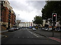
Southville Ward is a distinct district within Bristol, located on the south side of the River Avon just northwest of Bedminster. This compact neighbourhood covers 1.7 square kilometres and houses a population of 3,539 residents. The area exists as a defined ward under Bristol City Council, separate from its larger neighbour despite their close geographical proximity. You will find a lively urban environment shaped by its industrial past, where working-class community life developed around coal mining and manufacturing. Many historic houses were built during the late 19th and early 20th centuries to house workers employed in the tobacco industry, particularly at the Imperial Tobacco offices which once stood there. Living in Southville Ward means experiencing an area with a strong historical identity that continues to define the local atmosphere today. The ward has been politically notable for electing Bristol's first Green councillor in 2006, with Green representation continuing in subsequent years. You are choosing a location with a rich industrial heritage and a distinct political character, offering a specific type of urban living experience different from other parts of Bristol.
- Area Type
- District Borough Unitary Ward
- Area Size
- 1.7 km²
- Population
- 3539
- Population Density
- 2062 people/km²
Demographics
The community profile of Southville Ward displays a very specific age distribution with a median age of 70 years old. This figure indicates that the population consists primarily of older residents. You will find a neighbourhood where the most common age group is the total population, reflecting the lack of younger demographics in the ward. With a population density of 2,062 people per square kilometre, the area is notably crowded given its small size of 1.7 square kilometres. Home ownership stands at 47 percent, meaning slightly more than half of the households do not own their property outright. This level of ownership suggests a significant rental sector or social housing presence within the ward. While specific data regarding ethnic groups, religious affiliations, and detailed household composition is not included in the current records, the area maintains a clearly defined residential character centred on its historical working-class roots. The demographic reality here is one of an established, older community where the majority of adults are senior citizens rather than families with young children or recent arrivals. This age skew influences the pace of life and the type of amenities that are a priority for residents, as the population structure differs markedly from many younger urban neighbourhoods.
Household Size
Accommodation Type
Tenure
Ethnic Group
Religion
Household Composition
Age
Household Deprivation
NS-SEC
Explore more demographic insights in this area
Go to Demographics tabPlanning
Planning Constraints
- Flood RiskPremium
- Ramsar Wetland SitesPremium
- Area of Outstanding Natural BeautyPremium
- Protected Nature ReservePremium
- Protected WoodlandPremium