Area Overview for South Perrott
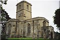
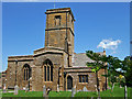
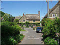
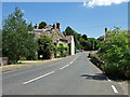
Photos of South Perrott

Area Information
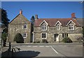
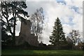
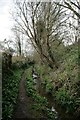
South Perrott is a civil parish in England comprising just 5.7 square kilometres. This small, defined boundary creates a close-knit settlement where daily life revolves around local amenities and established routines. The area is situated within a landscape that balances residential comfort with natural surroundings. You will find a community that has developed around specific local needs and established traditions rather than rapid expansion. Life here moves at a pace typical of smaller parishes, where neighbours often know each other and local services cater to a permanent population. The limited land area means that the distance between your home, shops, and public transport is usually quite short, reducing the need for long daily journeys. Living in South Perrott offers a distinct experience from larger towns or cities. The physical size of the parish dictates a quiet atmosphere without the noise of heavy traffic. You do not have to travel far to explore the full extent of the parish, which borders ona mix of open fields and settled housing. This geographical compactness fosters a sense of familiarity within the community. Whether you are walking to the local centre or needing to visit a specific landmark, the short distances make navigation straightforward. The area functions as a self-contained unit where the rhythm of life is influenced by both the season and the small, manageable population size. It is a place where residents can expect a clear, uncluttered environment defined by its modest scale.
- Area Type
- Parish
- Area Size
- 5.7 km²
- Population
- Not available
- Population Density
- Not available
Demographics
The community profile of South Perrott is heavily weighted towards older residents, with a median age reaching 70 years. This figure indicates that the parish is primarily inhabited by retirees or those approaching retirement age. Consequently, you will find a demographic that values stability and local independence over youthful nightlife or transient lifestyles. Family data confirms that the most common age range spans the entire adult population, reinforcing the absence of a large youth cohort. With a median age this high, the area caters specifically to those seeking a quieter life as their priorities shift in later adulthood. Home ownership is exceptionally prevalent in this parish, standing at 76 per cent of all households. This statistic suggests that the vast majority of residents have purchased their properties and likely built equity over many decades. You are more likely to buy a home from an established owner than to rent from a landlord. The high ownership rate correlates with the older population profile, as long-term residents often stay in one place until they can no longer do so. Accommodation types throughout the parish reflect this history, featuring properties that have served multiple generations. The diversity of the population is minimal given the homogenous age profile, creating an environment where social interactions often centre on shared life stages. Deprivation levels are mitigated by the high rate of owned housing, suggesting financial stability within the resident base.
Household Size
Accommodation Type
Tenure
Ethnic Group
Religion
Household Composition
Age
Household Deprivation
NS-SEC
Explore more demographic insights in this area
Go to Demographics tabPlanning
Planning Constraints
- Flood RiskPremium
- Ramsar Wetland SitesPremium
- Area of Outstanding Natural BeautyPremium
- Protected Nature ReservePremium
- Crime RiskPremium