Area Overview for Pilton
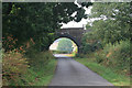
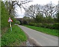
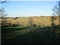
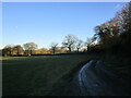
Photos of Pilton


Area Information
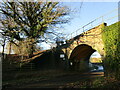
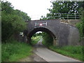
Living in Pilton means residing in a small civil parish located within North Northamptonshire, England. This hamlet covers an area of 1.4 square kilometres and sits at coordinates indicating its position in the East Midlands region. The location derives its name from historical references to 'Pileca's farm or settlement'. Currently, the population of Pilton is officially counted as part of the larger neighbouring civil parish of Wadenhoe. This administrative arrangement defines the local governance structure for the community. The area functions as a quiet residential pocket within the modern unitary authority of North Northamptonshire. Prospective buyers should note the significant distance from major urban centres, as the terrain typical of this region is predominantly rural. Daily life here revolves around the slow pace of a village setting rather than urban convenience. The physical boundaries of the parish are distinct from the broader Wadenhoe population count you will encounter in census reports. Understanding this geographical and administrative split is essential for property searches. Residents enjoy a setting defined by农田 and low-density housing rather than high-rise developments. The name Pilton remains consistent across official maps and historical records. You will find this area fits the definition of a traditional English hamlet.
- Area Type
- Parish
- Area Size
- 1.4 km²
- Population
- Not available
- Population Density
- Not available
Demographics
The community profile in Pilton reveals a distinctly senior population. The median age for residents is 70 years, which indicates a retired demographic rather than families with young children. While data does not specify the exact age breakdown beyond the median, the prevailing age group aligns with this older average. Home ownership stands at a high level of 73 percent. This figure suggests that most households in Pilton have paid off their mortgages and remain in their long-term properties. Household composition data is aggregated under general totals without specific breakdowns for family types or single-person households. Similarly, information regarding predominant ethnic groups and religious affiliation is summarised under total figures. The lack of granular data on diversity prevents a detailed cultural analysis of the neighbourhood. You should anticipate a community where longer-term residents dominate the social fabric. The 73 percent ownership rate also implies stability in the local housing stock with fewer transient tenants. This demographic structure contrasts sharply with typical family-centric villages found in major urban growth corridors. Formerly part of East Northamptonshire, the parish now operates under the unitary authority that includes Wadenhoe.
Household Size
Accommodation Type
Tenure
Ethnic Group
Religion
Household Composition
Age
Household Deprivation
NS-SEC
Explore more demographic insights in this area
Go to Demographics tabPlanning
Planning Constraints
- Flood RiskPremium
- Ramsar Wetland SitesPremium
- Area of Outstanding Natural BeautyPremium
- Protected Nature ReservePremium
- Protected WoodlandPremium