Area Overview for Mark
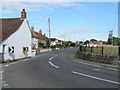
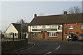
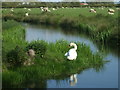
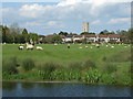
Photos of Mark


Area Information
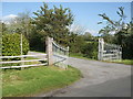
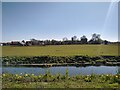
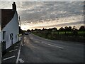
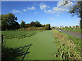
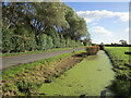
Mark is a civil parish located in England with a total land area of 21.5 square kilometres. Living in Mark means accepting a location defined by significant environmental considerations as much as residential comfort. The area presents a clear choice for potential residents who prioritise safety from flooding while weighing local planning constraints. You will find a community where the majority of properties are owned outright, suggesting a stable, long-term resident base rather than a transient rental market. Daily life here is shaped by specific geographical features that impact how you experience the neighbourhood. The village operates with high digital connectivity, ensuring your remote work setup remains reliable. However, you must acknowledge the serious implications of high flood risk coverage within the parish boundaries. This factor distinguishes Mark from other nearby settlements and requires careful consideration before purchase. The infrastructure supports modern living needs through robust network connections, yet the natural landscape imposes limits on certain developments. Your experience in Mark will depend heavily on how you navigate these environmental realities alongside the local housing stock. It is not a generic rural village but a specific settlement with defined character. Residents here have adapted to a environment where land use regulations and safety assessments play a central role in planning and property values. The area offers a quiet setting with excellent mobile coverage, making it suitable for those who value digital independence. You can expect a environment where ownership stable compared to national averages, reflecting a population committed to their homes. The size of the parish provides space for residents to live without overcrowding, though the flood risk remains a constant feature of the local landscape.
- Area Type
- Parish
- Area Size
- 21.5 km²
- Population
- Not available
- Population Density
- Not available
Demographics
The community in Mark reflects an older population profile, with a median age of 70 years. This age demographic indicates that the area attracts retirees or older families who have settled permanently. You will encounter a neighbourhood where the typical resident falls into the Age category encompassing the total population distribution. Home ownership stands at an impressive 83%, which is significantly higher than the national average. This statistic confirms that Mark is primarily an owner-occupied parish where most families reside in their own homes rather than renting. The household composition data covers the total population, suggesting a stable structure without large pockets of student housing or high-turnover tenant blocks. You will not find significant variation in accommodation types or predominant ethnic groups within the available records. The high rate of ownership points to a community where people intend to live in Mark for the long term. This stability creates a specific atmosphere where residents know one another better than in transient towns. Although specific details on household types are aggregated under the total category, the dominance of homeowners implies single-family dwellings and established family structures. Your experience living in Mark will align with a mature community where the average resident has spent decades living in the same area. The low proportion of renters means fewer transient populations and more investment in local amenities. When you consider homes in Mark, you are entering a market driven by owners who value stability over speculation. The demographic profile suggests you will find a siteless, quiet environment suited to those seeking a retirement location or a place to downsize. The data shows a clear separation from younger, working-age populations who might prefer larger transport networks or proximity to city centres.
Household Size
Accommodation Type
Tenure
Ethnic Group
Religion
Household Composition
Age
Household Deprivation
NS-SEC
Explore more demographic insights in this area
Go to Demographics tabPlanning
Planning Constraints
- Flood RiskPremium
- Ramsar Wetland SitesPremium
- Area of Outstanding Natural BeautyPremium
- Protected Nature ReservePremium
- Protected WoodlandPremium