Area Overview for Radstock
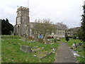
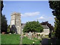
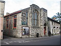
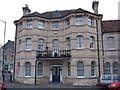
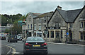
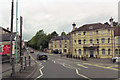
Photos of Radstock


Area Information
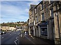
Living in Radstock offers a distinct blend of compact urban living and accessible amenities. Situated in England, this built-up area spans 3.2 km², creating a tightly knit community where daily life is shaped by proximity to essential services. With a median age of 70, the population reflects a demographic skewed towards older residents, influencing the area’s pace and character. Homeownership rates here are robust, at 72%, suggesting stability and long-term residency. The town’s charm lies in its practicality: nearby schools, retail outlets, and good digital connectivity make it suitable for those prioritising convenience over sprawling landscapes. Radstock’s appeal is rooted in its straightforward infrastructure, where the need to travel far for essentials is minimal. For buyers seeking a quieter, established community with a clear focus on accessibility, Radstock presents a straightforward proposition. Its compact size ensures that key services are within walking or short driving distance, while the presence of multiple primary schools and retail options adds to its practical allure.
- Area Type
- Built Up Area 250
- Area Size
- 3.2 km²
- Population
- Not available
- Population Density
- Not available
The lifestyle in Radstock is shaped by its proximity to essential amenities. Within practical reach are five retail outlets, including Morrisons Daily and The Radstock Co-operative Society Co, providing access to groceries, household goods, and everyday necessities. These shops contribute to a self-contained community where residents can meet daily needs without venturing far. While the data does not specify dining or leisure options, the presence of multiple retail venues suggests a focus on convenience. The area’s compact size means that amenities are clustered, reducing travel time for errands. For those valuing a straightforward, no-frills lifestyle, Radstock’s amenities offer practicality over variety, ensuring essentials are always within reach.
Amenities
Schools
Radstock is served by five primary schools, including Radstock Infant School, Westfield Primary School, Clandown CofE Primary School, St Nicholas CofE Infant School, and St Mary’s Church of England Primary School. All are primary institutions, offering education for younger children. The presence of multiple schools suggests a focus on early education, with options for both state and church-affiliated institutions. Families with young children will find the availability of several primary schools advantageous, though secondary education options are not detailed in the data. The concentration of primary schools indicates a community prioritising local schooling, reducing the need for long commutes. For parents seeking a range of educational environments, Radstock’s schools provide a foundation for early learning.
| Rank | School | Type | Entry gender | Ages |
|---|
Explore more schools in this area
Go to Schools tabDemographics
Radstock’s population is defined by its median age of 70, the highest in the dataset, indicating a predominantly older demographic. This age profile shapes the community’s dynamics, with a focus on stability and long-term residency. Homeownership is strong, with 72% of households owning their homes, suggesting a settled population less inclined to frequent relocation. The data does not specify household composition or accommodation types, but the high home ownership rate implies a mix of family homes and single-occupancy properties. The predominant ethnic group and religious composition are not detailed, but the figures provided confirm a homogenous demographic structure. The absence of specific deprivation data means the area’s quality of life cannot be assessed in terms of economic hardship, though the low crime risk and accessible amenities suggest a functional, if unremarkable, living environment.