Area Overview for SN9 6HX
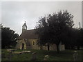
Photos of SN9 6HX
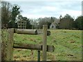
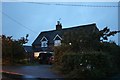
![Gently flows the Avon [1] in SN9 6HX](https://images.propbar.co.uk/images/geograph/53/58/5358357_120.jpg)
32 photos from this area
Area Information
Key information about the SN9 6HX including its size, population, and administrative classification.
- Area Type
- Postcode
- Area Size
- 2.1 hectares
- Population
- 1983
- Population Density
- 37 people/km²
House Prices in SN9 6HX
2
Properties
£415,000
Average Sold Price
£415,000
Lowest Price
£415,000
Highest Price
Showing 2 properties
| Address | Type | Beds | Baths | Last Sale Price | Last Sale Date | |
|---|---|---|---|---|---|---|
| 2, Main Road Cottages, A 345 From Junction With C 52 North East To Field Cottages, Manningford Bruce, SN9 6HX | Semi-detached | 4 | 2 | £415,000 | Jan 2025 | |
| 1, Main Road Cottages, A 345 From Junction With C 52 North East To Field Cottages, Manningford Bruce, SN9 6HX | Semi-detached | - | - | - | - |
Energy Efficiency in SN9 6HX
Amenities
Schools
| Rank | School | Type | Entry gender | Ages |
|---|
Explore more schools in this area
Go to Schools tabDemographics
Household Size
Two person
most common
Accommodation Type
Houses
most common
Tenure
63
majority
Ethnic Group
White
most common
Religion
N/A
most common
Household Composition
N/A
most common
Age
47
median
Adults (30-64 years)
most common
Household Deprivation
N/A
with no deprivation
NS-SEC
43
in Lower managerial occupations
Explore more demographic insights in this area
Go to Demographics tabPlanning
Planning Constraints
- Flood RiskPremium
- Ramsar Wetland SitesPremium
- Area of Outstanding Natural BeautyPremium
- Protected Nature ReservePremium
- Protected WoodlandPremium