Area Overview for SN9 5LQ
Photos of SN9 5LQ
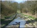
![Awaiting its turn [1] in SN9 5LQ](https://images.propbar.co.uk/images/geograph/55/36/5536728_120.jpg)
![Awaiting its turn [2] in SN9 5LQ](https://images.propbar.co.uk/images/geograph/55/36/5536729_120.jpg)
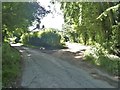
![Outlying farm buildings and yard [1] in SN9 5LQ](https://images.propbar.co.uk/images/geograph/55/36/5536737_120.jpg)
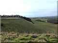
![Up the escarpment [1] in SN9 5LQ](https://images.propbar.co.uk/images/geograph/55/36/5536774_120.jpg)
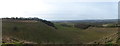
![View from the escarpment [1] in SN9 5LQ](https://images.propbar.co.uk/images/geograph/55/36/5536777_120.jpg)
![Up the escarpment [2] in SN9 5LQ](https://images.propbar.co.uk/images/geograph/55/36/5536782_120.jpg)
21 photos from this area
Area Information
Key information about the SN9 5LQ including its size, population, and administrative classification.
- Area Type
- Postcode
- Area Size
- 2.9 km²
- Population
- 1590
- Population Density
- 28 people/km²
House Prices in SN9 5LQ
65
Properties
£743,714
Average Sold Price
£170,000
Lowest Price
£2,175,000
Highest Price
Showing 65 properties
Page 1 of 7
Energy Efficiency in SN9 5LQ
Amenities
Schools
| Rank | School | Type | Entry gender | Ages |
|---|
Explore more schools in this area
Go to Schools tabDemographics
Household Size
Two person
most common
Accommodation Type
Houses
most common
Tenure
72
majority
Ethnic Group
White
most common
Religion
N/A
most common
Household Composition
N/A
most common
Age
47
median
Adults (30-64 years)
most common
Household Deprivation
N/A
with no deprivation
NS-SEC
42
in Lower managerial occupations
Explore more demographic insights in this area
Go to Demographics tabPlanning
Planning Constraints
- Flood RiskPremium
- Ramsar Wetland SitesPremium
- Area of Outstanding Natural BeautyPremium
- Protected Nature ReservePremium
- Protected WoodlandPremium