Area Overview for SN9 5JD
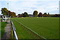
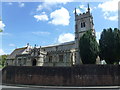
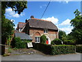
Photos of SN9 5JD
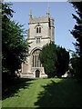
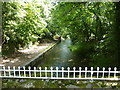
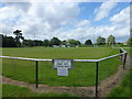
![River Avon at Pewsey [3] in SN9 5JD](https://images.propbar.co.uk/images/geograph/52/34/5234365_120.jpg)
100 photos from this area
Area Information
Key information about the SN9 5JD including its size, population, and administrative classification.
- Area Type
- Postcode
- Area Size
- 12.7 hectares
- Population
- 1950
- Population Density
- 158 people/km²
House Prices in SN9 5JD
12
Properties
£270,573
Average Sold Price
£146,866
Lowest Price
£401,000
Highest Price
Showing 12 properties
| Address | Type | Beds | Baths | Last Sale Price | Last Sale Date | |
|---|---|---|---|---|---|---|
| 27 Green Drove, Pewsey, SN9 5JD | Semi-detached | 3 | 1 | £310,000 | May 2025 | |
| 28 Green Drove, Pewsey, SN9 5JD | house | - | - | £146,866 | Apr 2024 | |
| 6, Highway House, Green Drove, Pewsey, SN9 5JD | Terraced | 3 | 2 | £250,000 | Aug 2015 | |
| Crofton, Green Drove, Pewsey, SN9 5JD | Detached | - | - | £401,000 | Oct 2004 | |
| Highway Cottage, Green Drove, Pewsey, SN9 5JD | house | - | - | £245,000 | Aug 2002 | |
| 3, Highway House, Green Drove, Pewsey, SN9 5JD | Flat | - | - | - | - | |
| 2, Highway House, Green Drove, Pewsey, SN9 5JD | Flat | - | - | - | - | |
| 5, Highway House, Green Drove, Pewsey, SN9 5JD | house | - | - | - | - | |
| Green Drove House, Green Drove, Pewsey, SN9 5JD | Detached | - | - | - | - | |
| Owenglendwr, Green Drove, Pewsey, SN9 5JD | Detached | - | - | - | - |
Page 1 of 2
Energy Efficiency in SN9 5JD
Amenities
Schools
| Rank | School | Type | Entry gender | Ages |
|---|
Explore more schools in this area
Go to Schools tabDemographics
Household Size
One person
most common
Accommodation Type
Houses
most common
Tenure
53
majority
Ethnic Group
White
most common
Religion
N/A
most common
Household Composition
N/A
most common
Age
47
median
Adults (30-64 years)
most common
Household Deprivation
N/A
with no deprivation
NS-SEC
30
in Lower managerial occupations
Explore more demographic insights in this area
Go to Demographics tabPlanning
Planning Constraints
- Flood RiskPremium
- Ramsar Wetland SitesPremium
- Area of Outstanding Natural BeautyPremium
- Protected Nature ReservePremium
- Protected WoodlandPremium