Area Overview for SN9 5EJ
Photos of SN9 5EJ
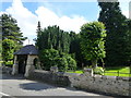
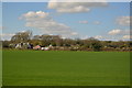

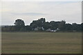

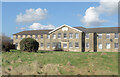
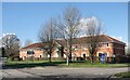
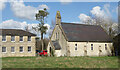
42 photos from this area
Area Information
Key information about the SN9 5EJ including its size, population, and administrative classification.
- Area Type
- Postcode
- Area Size
- 1.2 hectares
- Population
- 1950
- Population Density
- 158 people/km²
House Prices in SN9 5EJ
22
Properties
£178,150
Average Sold Price
£55,000
Lowest Price
£355,500
Highest Price
Showing 22 properties
| Address | Type | Beds | Baths | Last Sale Price | Last Sale Date | |
|---|---|---|---|---|---|---|
| 61 Wilcot Road, Pewsey, SN9 5EJ | Detached | 3 | 1 | £355,500 | Jun 2024 | |
| 37 Wilcot Road, Pewsey, SN9 5EJ | house | - | - | £140,000 | Sep 2017 | |
| Rose Cottage, 49 Wilcot Road, Pewsey, SN9 5EJ | house | 2 | 1 | £243,000 | May 2014 | |
| Medway, 55 Wilcot Road, Pewsey, SN9 5EJ | Cottage | 3 | - | £249,999 | Aug 2012 | |
| 35 Wilcot Road, Pewsey, SN9 5EJ | house | - | - | £205,000 | Nov 2010 | |
| 67 Wilcot Road, Pewsey, SN9 5EJ | Semi-detached | 2 | 1 | £130,000 | Jul 2009 | |
| 63 Wilcot Road, Pewsey, SN9 5EJ | Semi-detached | 3 | 1 | £186,000 | Nov 2007 | |
| 77 Wilcot Road, Pewsey, SN9 5EJ | Detached | - | - | £150,000 | Mar 2006 | |
| Pleasant Place, 73 Wilcot Road, Pewsey, SN9 5EJ | house | 3 | - | £196,000 | Feb 2006 | |
| 41 Wilcot Road, Pewsey, SN9 5EJ | Semi-detached | - | - | £149,950 | Feb 2003 |
Page 1 of 3
Energy Efficiency in SN9 5EJ
Amenities
Schools
| Rank | School | Type | Entry gender | Ages |
|---|
Explore more schools in this area
Go to Schools tabDemographics
Household Size
One person
most common
Accommodation Type
Houses
most common
Tenure
53
majority
Ethnic Group
White
most common
Religion
N/A
most common
Household Composition
N/A
most common
Age
47
median
Adults (30-64 years)
most common
Household Deprivation
N/A
with no deprivation
NS-SEC
30
in Lower managerial occupations
Explore more demographic insights in this area
Go to Demographics tabPlanning
Planning Constraints
- Flood RiskPremium
- Ramsar Wetland SitesPremium
- Area of Outstanding Natural BeautyPremium
- Protected Nature ReservePremium
- Protected WoodlandPremium