Area Overview for SN9 5DA
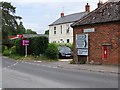
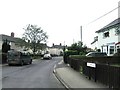
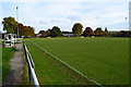
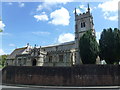
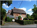
Photos of SN9 5DA
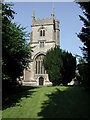
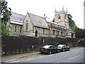
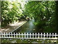
![River Avon at Pewsey [3] in SN9 5DA](https://images.propbar.co.uk/images/geograph/52/34/5234365_120.jpg)
100 photos from this area
Area Information
Key information about the SN9 5DA including its size, population, and administrative classification.
- Area Type
- Postcode
- Area Size
- 3324 m²
- Population
- 1846
- Population Density
- 273 people/km²
House Prices in SN9 5DA
10
Properties
£158,917
Average Sold Price
£42,250
Lowest Price
£300,000
Highest Price
Showing 10 properties
| Address | Type | Beds | Baths | Last Sale Price | Last Sale Date | |
|---|---|---|---|---|---|---|
| 4, Wilderness Row, Kings Corner, Pewsey, SN9 5DA | Terraced | 2 | 1 | £300,000 | Aug 2025 | |
| 6, Wilderness Row, Kings Corner, Pewsey, SN9 5DA | house | - | - | £250,000 | Jun 2017 | |
| 5, Wilderness Row, Kings Corner, Pewsey, SN9 5DA | Terraced | 2 | 1 | £187,500 | Aug 2014 | |
| 3, Wilderness Row, Kings Corner, Pewsey, SN9 5DA | Terraced | 3 | 1 | £207,500 | Apr 2014 | |
| 8, Wilderness Row, Kings Corner, Pewsey, SN9 5DA | Terraced | - | - | £175,000 | Aug 2007 | |
| 10, Wilderness Row, Kings Corner, Pewsey, SN9 5DA | Semi-detached | - | - | £132,500 | Nov 2002 | |
| 2, Wilderness Row, Kings Corner, Pewsey, SN9 5DA | house | - | - | £82,000 | Apr 2001 | |
| 9, Wilderness Row, Kings Corner, Pewsey, SN9 5DA | Terraced | - | - | £53,500 | Sep 1998 | |
| 1, Wilderness Row, Kings Corner, Pewsey, SN9 5DA | house | 3 | - | £42,250 | Aug 1995 | |
| 7, Wilderness Row, Kings Corner, Pewsey, SN9 5DA | house | - | - | - | - |
Energy Efficiency in SN9 5DA
Amenities
Schools
| Rank | School | Type | Entry gender | Ages |
|---|
Explore more schools in this area
Go to Schools tabDemographics
Household Size
Two person
most common
Accommodation Type
Houses
most common
Tenure
76
majority
Ethnic Group
White
most common
Religion
N/A
most common
Household Composition
N/A
most common
Age
47
median
Adults (30-64 years)
most common
Household Deprivation
N/A
with no deprivation
NS-SEC
44
in Lower managerial occupations
Explore more demographic insights in this area
Go to Demographics tabPlanning
Planning Constraints
- Flood RiskPremium
- Ramsar Wetland SitesPremium
- Area of Outstanding Natural BeautyPremium
- Protected Nature ReservePremium
- Protected WoodlandPremium