Area Overview for SN8 4JQ
Photos of SN8 4JQ
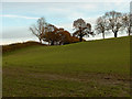
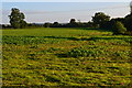

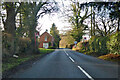
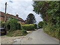
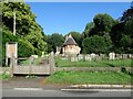
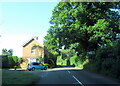
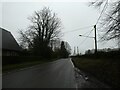
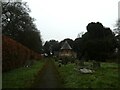
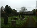
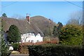
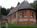
32 photos from this area
Area Information
Key information about the SN8 4JQ including its size, population, and administrative classification.
- Area Type
- Postcode
- Area Size
- 44.9 hectares
- Population
- 1590
- Population Density
- 28 people/km²
House Prices in SN8 4JQ
11
Properties
£547,500
Average Sold Price
£547,500
Lowest Price
£547,500
Highest Price
Showing 11 properties
| Address | Type | Beds | Baths | Last Sale Price | Last Sale Date | |
|---|---|---|---|---|---|---|
| The Old Bakery, A 345 Marlborough Road Pewsey Near Junction With Roads To Wilcot And Stowell Park North East To Oare, Oare, SN8 4JQ | Detached | 3 | 1 | £547,500 | Oct 2017 | |
| 2, Orchard Cottage, Rudge Lane, Oare, SN8 4JQ | Semi-detached | - | - | - | - | |
| 1, Orchard Cottage, Rudge Lane, Oare, SN8 4JQ | house | - | - | - | - | |
| Huntsmans Lodge, Draycott Fitzpayne East C 264 To Oare, Oare, SN8 4JQ | Detached | - | - | - | - | |
| Dairy Cottage, Draycott Fitzpayne East C 264 To Oare, Oare, SN8 4JQ | house | - | - | - | - | |
| Oare House, Rudge Lane, Oare, SN8 4JQ | Terraced | - | - | - | - | |
| Stable Flat, Oare House, Rudge Lane, Oare, SN8 4JQ | Semi-detached | - | - | - | - | |
| Garage Flat, Oare House, Rudge Lane, Oare, SN8 4JQ | Semi-detached | - | - | - | - | |
| Flat, Oare House, Rudge Lane, Oare, SN8 4JQ | Flat | - | - | - | - | |
| The Lodge, A 345 Marlborough Road Pewsey Near Junction With Roads To Wilcot And Stowell Park North East To Oare, Oare, SN8 4JQ | Detached | - | - | - | - |
Page 1 of 2
Energy Efficiency in SN8 4JQ
Amenities
Schools
| Rank | School | Type | Entry gender | Ages |
|---|
Explore more schools in this area
Go to Schools tabDemographics
Household Size
Two person
most common
Accommodation Type
Houses
most common
Tenure
72
majority
Ethnic Group
White
most common
Religion
N/A
most common
Household Composition
N/A
most common
Age
47
median
Adults (30-64 years)
most common
Household Deprivation
N/A
with no deprivation
NS-SEC
42
in Lower managerial occupations
Explore more demographic insights in this area
Go to Demographics tabPlanning
Planning Constraints
- Flood RiskPremium
- Ramsar Wetland SitesPremium
- Area of Outstanding Natural BeautyPremium
- Protected Nature ReservePremium
- Protected WoodlandPremium