Area Overview for SN8 4ES
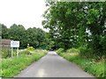
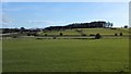
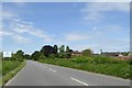
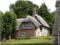
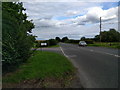
Photos of SN8 4ES
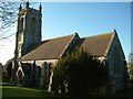

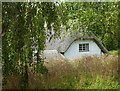
![West Overton houses [2] in SN8 4ES](https://images.propbar.co.uk/images/geograph/58/94/5894245_120.jpg)
![West Overton houses [3] in SN8 4ES](https://images.propbar.co.uk/images/geograph/58/94/5894255_120.jpg)
![West Overton houses [4] in SN8 4ES](https://images.propbar.co.uk/images/geograph/58/94/5894264_120.jpg)
57 photos from this area
Area Information
Key information about the SN8 4ES including its size, population, and administrative classification.
- Area Type
- Postcode
- Area Size
- 2243 m²
- Population
- 1707
- Population Density
- 33 people/km²
House Prices in SN8 4ES
4
Properties
£145,833
Average Sold Price
£98,500
Lowest Price
£175,000
Highest Price
Showing 4 properties
| Address | Type | Beds | Baths | Last Sale Price | Last Sale Date | |
|---|---|---|---|---|---|---|
| 3, The Grange, Area Boundary Near East Kennett East C 202 To Junction With Church Hill West Overton, West Overton, SN8 4ES | Terraced | - | - | £164,000 | Nov 2001 | |
| 1, The Grange, Area Boundary Near East Kennett East C 202 To Junction With Church Hill West Overton, West Overton, SN8 4ES | Terraced | - | - | £175,000 | Apr 2001 | |
| 2, The Grange, Area Boundary Near East Kennett East C 202 To Junction With Church Hill West Overton, West Overton, SN8 4ES | Terraced | - | - | £98,500 | Jul 1998 | |
| 4, The Grange, Area Boundary Near East Kennett East C 202 To Junction With Church Hill West Overton, West Overton, SN8 4ES | Terraced | - | - | - | - |
Energy Efficiency in SN8 4ES
Amenities
Schools
| Rank | School | Type | Entry gender | Ages |
|---|
Explore more schools in this area
Go to Schools tabDemographics
Household Size
Two person
most common
Accommodation Type
Houses
most common
Tenure
71
majority
Ethnic Group
White
most common
Religion
N/A
most common
Household Composition
N/A
most common
Age
47
median
Adults (30-64 years)
most common
Household Deprivation
N/A
with no deprivation
NS-SEC
46
in Lower managerial occupations
Explore more demographic insights in this area
Go to Demographics tabPlanning
Planning Constraints
- Flood RiskPremium
- Ramsar Wetland SitesPremium
- Area of Outstanding Natural BeautyPremium
- Protected Nature ReservePremium
- Protected WoodlandPremium