Area Overview for SN8 4EN
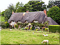
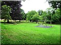
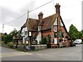
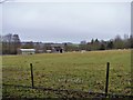
Photos of SN8 4EN
![Start of bridleway [2] in SN8 4EN](https://images.propbar.co.uk/images/geograph/56/60/5660514_120.jpg)
![Lockeridge houses [1] in SN8 4EN](https://images.propbar.co.uk/images/geograph/56/60/5660549_120.jpg)
![Lockeridge houses [2] in SN8 4EN](https://images.propbar.co.uk/images/geograph/56/60/5660557_120.jpg)
![Lockeridge houses [3] in SN8 4EN](https://images.propbar.co.uk/images/geograph/63/56/6356835_120.jpg)
![Lockeridge features [1] in SN8 4EN](https://images.propbar.co.uk/images/geograph/63/56/6356837_120.jpg)
![Lockeridge houses [4] in SN8 4EN](https://images.propbar.co.uk/images/geograph/63/56/6356840_120.jpg)
![Lockeridge houses [6] in SN8 4EN](https://images.propbar.co.uk/images/geograph/63/56/6356864_120.jpg)
![Lockeridge houses [7] in SN8 4EN](https://images.propbar.co.uk/images/geograph/63/56/6356865_120.jpg)
61 photos from this area
Area Information
Key information about the SN8 4EN including its size, population, and administrative classification.
- Area Type
- Postcode
- Area Size
- 7003 m²
- Population
- 1707
- Population Density
- 33 people/km²
House Prices in SN8 4EN
4
Properties
£425,000
Average Sold Price
£360,000
Lowest Price
£490,000
Highest Price
Showing 4 properties
| Address | Type | Beds | Baths | Last Sale Price | Last Sale Date | |
|---|---|---|---|---|---|---|
| 3, Old Meadow Cottages, Primary School North C 38 To Lockeridge House, Lockeridge, SN8 4EN | Cottage | 3 | 1 | £490,000 | Nov 2023 | |
| 4, Old Meadow Cottages, Primary School North C 38 To Lockeridge House, Lockeridge, SN8 4EN | house | - | - | £360,000 | Dec 2019 | |
| 1, Old Meadow Cottages, Primary School North C 38 To Lockeridge House, Lockeridge, SN8 4EN | house | - | - | - | - | |
| 2, Old Meadow Cottages, Primary School North C 38 To Lockeridge House, Lockeridge, SN8 4EN | house | - | - | - | - |
Energy Efficiency in SN8 4EN
Amenities
Schools
| Rank | School | Type | Entry gender | Ages |
|---|
Explore more schools in this area
Go to Schools tabDemographics
Household Size
Two person
most common
Accommodation Type
Houses
most common
Tenure
71
majority
Ethnic Group
White
most common
Religion
N/A
most common
Household Composition
N/A
most common
Age
47
median
Adults (30-64 years)
most common
Household Deprivation
N/A
with no deprivation
NS-SEC
46
in Lower managerial occupations
Explore more demographic insights in this area
Go to Demographics tabPlanning
Planning Constraints
- Flood RiskPremium
- Ramsar Wetland SitesPremium
- Area of Outstanding Natural BeautyPremium
- Protected Nature ReservePremium
- Protected WoodlandPremium