Area Overview for SN8 3PW
Photos of SN8 3PW
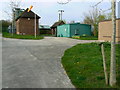
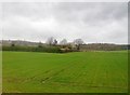
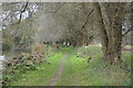
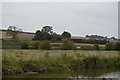
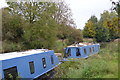
69 photos from this area
Area Information
Key information about the SN8 3PW including its size, population, and administrative classification.
- Area Type
- Postcode
- Area Size
- 3.0 hectares
- Population
- 1790
- Population Density
- 48 people/km²
House Prices in SN8 3PW
19
Properties
£345,103
Average Sold Price
£105,000
Lowest Price
£795,000
Highest Price
Showing 19 properties
| Address | Type | Beds | Baths | Last Sale Price | Last Sale Date | |
|---|---|---|---|---|---|---|
| 10 Wansdyke Road, Great Bedwyn, SN8 3PW | Detached | - | - | £150,000 | Mar 2024 | |
| 1 Wansdyke Road, Great Bedwyn, SN8 3PW | Detached | 5 | 2 | £685,000 | Aug 2023 | |
| 5 Wansdyke Road, Great Bedwyn, SN8 3PW | house | - | - | £795,000 | Jun 2021 | |
| 32 Wansdyke Road, Great Bedwyn, SN8 3PW | Semi-detached | 3 | 2 | £369,000 | Dec 2020 | |
| 24 Wansdyke Road, Great Bedwyn, SN8 3PW | Detached | 3 | 2 | £420,000 | Jan 2020 | |
| 16 Wansdyke Road, Great Bedwyn, SN8 3PW | Detached | 3 | - | £335,000 | Jan 2016 | |
| 20 Wansdyke Road, Great Bedwyn, SN8 3PW | Detached | 4 | - | £375,000 | Jan 2015 | |
| The Gwineas, 8 Wansdyke Road, Great Bedwyn, SN8 3PW | house | 5 | - | £475,000 | Jul 2010 | |
| 14 Wansdyke Road, Great Bedwyn, SN8 3PW | Detached | 5 | 2 | £335,000 | May 2007 | |
| 28 Wansdyke Road, Great Bedwyn, SN8 3PW | house | 3 | - | £275,000 | May 2007 |
Page 1 of 2
Energy Efficiency in SN8 3PW
Amenities
Schools
| Rank | School | Type | Entry gender | Ages |
|---|
Explore more schools in this area
Go to Schools tabDemographics
Household Size
Two person
most common
Accommodation Type
Houses
most common
Tenure
65
majority
Ethnic Group
White
most common
Religion
N/A
most common
Household Composition
N/A
most common
Age
47
median
Adults (30-64 years)
most common
Household Deprivation
N/A
with no deprivation
NS-SEC
41
in Lower managerial occupations
Explore more demographic insights in this area
Go to Demographics tabPlanning
Planning Constraints
- Flood RiskPremium
- Ramsar Wetland SitesPremium
- Area of Outstanding Natural BeautyPremium
- Protected Nature ReservePremium
- Protected WoodlandPremium