Area Overview for SN8 3PF
Photos of SN8 3PF
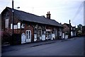
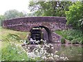
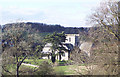
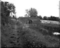
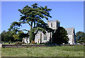
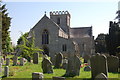
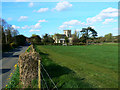

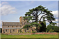
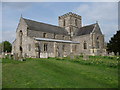
100 photos from this area
Area Information
Key information about the SN8 3PF including its size, population, and administrative classification.
- Area Type
- Postcode
- Area Size
- 4.3 hectares
- Population
- 1790
- Population Density
- 48 people/km²
House Prices in SN8 3PF
52
Properties
£440,846
Average Sold Price
£76,000
Lowest Price
£1,275,000
Highest Price
Showing 52 properties
| Address | Type | Beds | Baths | Last Sale Price | Last Sale Date | |
|---|---|---|---|---|---|---|
| 68 Church Street, Great Bedwyn, SN8 3PF | Semi-detached | 3 | 2 | £365,000 | Aug 2025 | |
| 69 Church Street, Great Bedwyn, SN8 3PF | Semi-detached | 2 | 1 | £395,000 | Dec 2024 | |
| 70 Church Street, Great Bedwyn, SN8 3PF | Semi-detached | 3 | 1 | £338,000 | Dec 2023 | |
| The Old White Hart, 95 Church Street, Great Bedwyn, SN8 3PF | house | - | - | £1,275,000 | Sep 2023 | |
| 65 Church Street, Great Bedwyn, SN8 3PF | Semi-detached | 3 | 2 | £420,000 | Aug 2023 | |
| Meadow View, 62A Church Street, Great Bedwyn, SN8 3PF | Detached | 3 | - | £700,000 | Nov 2022 | |
| 59 Church Street, Great Bedwyn, SN8 3PF | house | - | - | £510,000 | Dec 2021 | |
| 77 Church Street, Great Bedwyn, SN8 3PF | house | - | - | £360,000 | Sep 2021 | |
| 88 Church Street, Great Bedwyn, SN8 3PF | Detached | 2 | 1 | £675,000 | Sep 2021 | |
| 63 Church Street, Great Bedwyn, SN8 3PF | Semi-detached | - | - | £165,000 | Apr 2017 |
Page 1 of 6
Energy Efficiency in SN8 3PF
Amenities
Schools
| Rank | School | Type | Entry gender | Ages |
|---|
Explore more schools in this area
Go to Schools tabDemographics
Household Size
Two person
most common
Accommodation Type
Houses
most common
Tenure
65
majority
Ethnic Group
White
most common
Religion
N/A
most common
Household Composition
N/A
most common
Age
47
median
Adults (30-64 years)
most common
Household Deprivation
N/A
with no deprivation
NS-SEC
41
in Lower managerial occupations
Explore more demographic insights in this area
Go to Demographics tabPlanning
Planning Constraints
- Flood RiskPremium
- Ramsar Wetland SitesPremium
- Area of Outstanding Natural BeautyPremium
- Protected Nature ReservePremium
- Protected WoodlandPremium