Area Overview for SN8 3LY
Photos of SN8 3LY
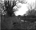
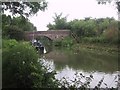
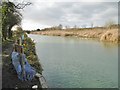
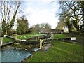
![Mill Bridge [No 97] from the east in SN8 3LY](https://images.propbar.co.uk/images/geograph/44/94/4494974_120.jpg)

87 photos from this area
Area Information
Key information about the SN8 3LY including its size, population, and administrative classification.
- Area Type
- Postcode
- Area Size
- 1.4 km²
- Population
- 1790
- Population Density
- 48 people/km²
House Prices in SN8 3LY
4
Properties
£1,000,000
Average Sold Price
£1,000,000
Lowest Price
£1,000,000
Highest Price
Showing 4 properties
| Address | Type | Beds | Baths | Last Sale Price | Last Sale Date | |
|---|---|---|---|---|---|---|
| Oak Lodge, Church Street South To Wilton Brail, Great Bedwyn, SN8 3LY | Detached | - | - | £1,000,000 | Oct 2008 | |
| Brail Farmhouse, Church Street South To Wilton Brail, Great Bedwyn, SN8 3LY | Semi-detached | 4 | - | - | - | |
| Oak Lodge Stables, Church Street South To Wilton Brail, Great Bedwyn, SN8 3LY | Equestrian | - | - | - | - | |
| Mill House, Crofton Road, Great Bedwyn, SN8 3LY | Detached | - | - | - | - |
Energy Efficiency in SN8 3LY
Amenities
Schools
| Rank | School | Type | Entry gender | Ages |
|---|
Explore more schools in this area
Go to Schools tabDemographics
Household Size
Two person
most common
Accommodation Type
Houses
most common
Tenure
65
majority
Ethnic Group
White
most common
Religion
N/A
most common
Household Composition
N/A
most common
Age
47
median
Adults (30-64 years)
most common
Household Deprivation
N/A
with no deprivation
NS-SEC
41
in Lower managerial occupations
Explore more demographic insights in this area
Go to Demographics tabPlanning
Planning Constraints
- Flood RiskPremium
- Ramsar Wetland SitesPremium
- Area of Outstanding Natural BeautyPremium
- Protected Nature ReservePremium
- Protected WoodlandPremium