Area Overview for SN8 3LG
Photos of SN8 3LG
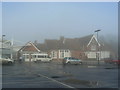
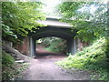
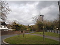
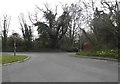
![Road over former railway [1] in SN8 3LG](https://images.propbar.co.uk/images/geograph/54/68/5468843_120.jpg)
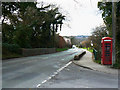
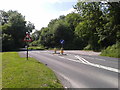
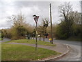
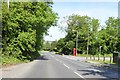
![Marlborough ways [24] in SN8 3LG](https://images.propbar.co.uk/images/geograph/54/69/5469880_120.jpg)
32 photos from this area
Area Information
Key information about the SN8 3LG including its size, population, and administrative classification.
- Area Type
- Postcode
- Area Size
- 25.0 hectares
- Population
- 1590
- Population Density
- 28 people/km²
House Prices in SN8 3LG
38
Properties
£376,377
Average Sold Price
£78,500
Lowest Price
£765,000
Highest Price
Showing 38 properties
| Address | Type | Beds | Baths | Last Sale Price | Last Sale Date | |
|---|---|---|---|---|---|---|
| 10 Maurice Way, Marlborough, SN8 3LG | Detached | 6 | 4 | £730,000 | Jul 2025 | |
| 38 Maurice Way, Marlborough, SN8 3LG | house | - | - | £765,000 | Nov 2022 | |
| 39 Maurice Way, Marlborough, SN8 3LG | Detached | 5 | 3 | £550,000 | Apr 2022 | |
| 30 Maurice Way, Marlborough, SN8 3LG | Flat | 2 | 1 | £123,000 | Jan 2022 | |
| 21 Maurice Way, Marlborough, SN8 3LG | Terraced | 3 | 1 | £305,000 | Dec 2021 | |
| 2 Maurice Way, Marlborough, SN8 3LG | Semi-detached | 3 | 3 | £400,000 | Dec 2021 | |
| 24 Maurice Way, Marlborough, SN8 3LG | Flat | 2 | 1 | £93,750 | Mar 2021 | |
| 20 Maurice Way, Marlborough, SN8 3LG | Semi-detached | 3 | 2 | £310,000 | Feb 2020 | |
| 23 Maurice Way, Marlborough, SN8 3LG | Terraced | 3 | 2 | £370,000 | Sep 2017 | |
| 7 Maurice Way, Marlborough, SN8 3LG | Detached | 5 | 3 | £450,000 | Jun 2017 |
Page 1 of 4
Energy Efficiency in SN8 3LG
Amenities
Schools
| Rank | School | Type | Entry gender | Ages |
|---|
Explore more schools in this area
Go to Schools tabDemographics
Household Size
Two person
most common
Accommodation Type
Houses
most common
Tenure
72
majority
Ethnic Group
White
most common
Religion
N/A
most common
Household Composition
N/A
most common
Age
47
median
Adults (30-64 years)
most common
Household Deprivation
N/A
with no deprivation
NS-SEC
42
in Lower managerial occupations
Explore more demographic insights in this area
Go to Demographics tabPlanning
Planning Constraints
- Flood RiskPremium
- Ramsar Wetland SitesPremium
- Area of Outstanding Natural BeautyPremium
- Protected Nature ReservePremium
- Protected WoodlandPremium