Area Overview for SN8 3JY
Photos of SN8 3JY
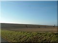
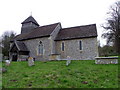
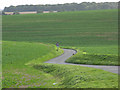
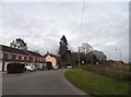
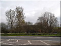
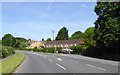
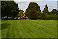
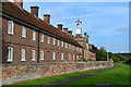
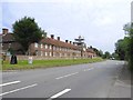
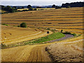
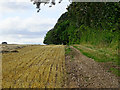
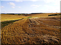
40 photos from this area
Area Information
Key information about the SN8 3JY including its size, population, and administrative classification.
- Area Type
- Postcode
- Area Size
- 1.2 km²
- Population
- 1844
- Population Density
- 29 people/km²
House Prices in SN8 3JY
31
Properties
£518,883
Average Sold Price
£2,500
Lowest Price
£1,870,000
Highest Price
Showing 31 properties
| Address | Type | Beds | Baths | Last Sale Price | Last Sale Date | |
|---|---|---|---|---|---|---|
| 23 Church Road, Froxfield, SN8 3JY | Cottage | 2 | 1 | £427,500 | Feb 2023 | |
| 16 Church Road, Froxfield, SN8 3JY | Semi-detached | 3 | 1 | £425,000 | Dec 2022 | |
| 15 Church Road, Froxfield, SN8 3JY | Terraced | 2 | 1 | £385,000 | Mar 2022 | |
| 22 Church Road, Froxfield, SN8 3JY | house | 3 | 2 | £360,000 | Feb 2021 | |
| The Willows, London Road, Froxfield, SN8 3JY | Detached | - | - | £2,500 | Mar 2020 | |
| Green Farm, Church Road, Froxfield, SN8 3JY | house | - | - | £500,000 | Apr 2019 | |
| 14 Church Road, Froxfield, SN8 3JY | Terraced | 2 | 1 | £289,950 | Jul 2015 | |
| The Old Vicarage, Church Road, Froxfield, SN8 3JY | house | - | - | £1,250,000 | Oct 2013 | |
| Froxfield Manor, Littlecote Road, Froxfield, SN8 3JY | Land | - | - | £1,870,000 | Sep 2013 | |
| 13 Church Road, Froxfield, SN8 3JY | house | 2 | - | £250,000 | Jun 2012 |
Page 1 of 4
Energy Efficiency in SN8 3JY
Amenities
Schools
| Rank | School | Type | Entry gender | Ages |
|---|
Explore more schools in this area
Go to Schools tabDemographics
Household Size
Two person
most common
Accommodation Type
Houses
most common
Tenure
65
majority
Ethnic Group
White
most common
Religion
N/A
most common
Household Composition
N/A
most common
Age
47
median
Adults (30-64 years)
most common
Household Deprivation
N/A
with no deprivation
NS-SEC
44
in Lower managerial occupations
Explore more demographic insights in this area
Go to Demographics tabPlanning
Planning Constraints
- Flood RiskPremium
- Ramsar Wetland SitesPremium
- Area of Outstanding Natural BeautyPremium
- Protected Nature ReservePremium
- Protected WoodlandPremium