Area Overview for SN8 3AF
Photos of SN8 3AF
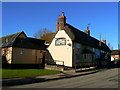
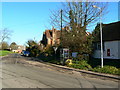
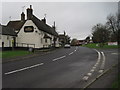
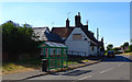
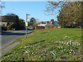
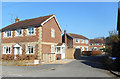

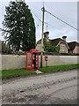
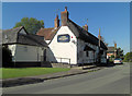
18 photos from this area
Area Information
Key information about the SN8 3AF including its size, population, and administrative classification.
- Area Type
- Postcode
- Area Size
- 17.3 hectares
- Population
- 1931
- Population Density
- 111 people/km²
House Prices in SN8 3AF
39
Properties
£544,350
Average Sold Price
£153,000
Lowest Price
£1,450,000
Highest Price
Showing 39 properties
| Address | Type | Beds | Baths | Last Sale Price | Last Sale Date | |
|---|---|---|---|---|---|---|
| 57 High Street, Burbage, SN8 3AF | Semi-detached | 2 | 1 | £345,000 | Mar 2025 | |
| Pine Edge, 49 High Street, Burbage, SN8 3AF | Bungalow | 4 | 2 | £592,000 | Nov 2023 | |
| 59 High Street, Burbage, SN8 3AF | Semi-detached | 2 | 1 | £295,000 | Feb 2022 | |
| Box Cottage, 65 High Street, Burbage, SN8 3AF | Cottage | 4 | 2 | £660,000 | Nov 2021 | |
| Langfield House, 60 High Street, Burbage, SN8 3AF | Detached | 4 | - | £660,000 | Nov 2021 | |
| Pheasant Cottage, 61 High Street, Burbage, SN8 3AF | Detached | 3 | 1 | £755,000 | Aug 2021 | |
| 30 High Street, Burbage, SN8 3AF | Semi-detached | 3 | 1 | £407,000 | Aug 2021 | |
| High Banks, 51 High Street, Burbage, SN8 3AF | Bungalow | - | - | £485,000 | Apr 2021 | |
| 2 Scott Close, Burbage, SN8 3AF | house | 5 | - | £1,070,000 | Sep 2020 | |
| Philera, 56 High Street, Burbage, SN8 3AF | Bungalow | - | - | £350,000 | Mar 2018 |
Page 1 of 4
Energy Efficiency in SN8 3AF
Amenities
Schools
| Rank | School | Type | Entry gender | Ages |
|---|
Explore more schools in this area
Go to Schools tabDemographics
Household Size
Two person
most common
Accommodation Type
Houses
most common
Tenure
75
majority
Ethnic Group
White
most common
Religion
N/A
most common
Household Composition
N/A
most common
Age
47
median
Adults (30-64 years)
most common
Household Deprivation
N/A
with no deprivation
NS-SEC
41
in Lower managerial occupations
Explore more demographic insights in this area
Go to Demographics tabPlanning
Planning Constraints
- Flood RiskPremium
- Ramsar Wetland SitesPremium
- Area of Outstanding Natural BeautyPremium
- Protected Nature ReservePremium
- Protected WoodlandPremium