Area Overview for SN8 2LU
Photos of SN8 2LU
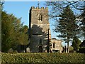


![Marlborough features [17] in SN8 2LU](https://images.propbar.co.uk/images/geograph/54/68/5468756_120.jpg)
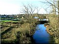
![Bridge on Elcot Lane [1] in SN8 2LU](https://images.propbar.co.uk/images/geograph/54/68/5468765_120.jpg)
![Marlborough buildings [20] in SN8 2LU](https://images.propbar.co.uk/images/geograph/54/68/5468770_120.jpg)
![Marlborough houses [24] in SN8 2LU](https://images.propbar.co.uk/images/geograph/54/68/5468780_120.jpg)
![Marlborough ways [28] in SN8 2LU](https://images.propbar.co.uk/images/geograph/54/68/5468781_120.jpg)
![Marlborough ways [29] in SN8 2LU](https://images.propbar.co.uk/images/geograph/54/68/5468815_120.jpg)
![Once were trains [1] in SN8 2LU](https://images.propbar.co.uk/images/geograph/54/68/5468837_120.jpg)
![Once were trains [2] in SN8 2LU](https://images.propbar.co.uk/images/geograph/54/68/5468841_120.jpg)
30 photos from this area
Area Information
Key information about the SN8 2LU including its size, population, and administrative classification.
- Area Type
- Postcode
- Area Size
- 14.0 hectares
- Population
- 1761
- Population Density
- 23 people/km²
House Prices in SN8 2LU
19
Properties
£871,071
Average Sold Price
£437,500
Lowest Price
£2,525,000
Highest Price
Showing 19 properties
| Address | Type | Beds | Baths | Last Sale Price | Last Sale Date | |
|---|---|---|---|---|---|---|
| Iona, Church Lane, Mildenhall, SN8 2LU | Retail | 3 | 1 | £560,000 | Aug 2022 | |
| Glebe House, Church Lane, Mildenhall, SN8 2LU | house | 1 | - | £2,525,000 | Feb 2022 | |
| The Cottage, Church Lane, Mildenhall, SN8 2LU | house | - | - | £535,000 | Jan 2020 | |
| Maytrees, Church Lane, Mildenhall, SN8 2LU | house | - | - | £520,000 | Sep 2016 | |
| Firbank, Church Lane, Mildenhall, SN8 2LU | house | - | - | £437,500 | Oct 2011 | |
| Wansdyke, Church Lane, Mildenhall, SN8 2LU | house | 4 | - | £685,000 | May 2011 | |
| Rectory Garden House, Church Lane, Mildenhall, SN8 2LU | house | 3 | 2 | £835,000 | Jun 2005 | |
| Alvor, Church Lane, Mildenhall, SN8 2LU | Detached | 6 | - | - | - | |
| The Stables, Kennet Cottage Yard, Church Lane, Mildenhall, SN8 2LU | Semi-detached | - | - | - | - | |
| Marlborough Cabinets, Church Farm, Church Lane, Mildenhall, SN8 2LU | Industrial | - | - | - | - |
Page 1 of 2
Energy Efficiency in SN8 2LU
Amenities
Schools
| Rank | School | Type | Entry gender | Ages |
|---|
Explore more schools in this area
Go to Schools tabDemographics
Household Size
Two person
most common
Accommodation Type
Houses
most common
Tenure
64
majority
Ethnic Group
White
most common
Religion
N/A
most common
Household Composition
N/A
most common
Age
47
median
Adults (30-64 years)
most common
Household Deprivation
N/A
with no deprivation
NS-SEC
44
in Lower managerial occupations
Explore more demographic insights in this area
Go to Demographics tabPlanning
Planning Constraints
- Flood RiskPremium
- Ramsar Wetland SitesPremium
- Area of Outstanding Natural BeautyPremium
- Protected Nature ReservePremium
- Protected WoodlandPremium