Area Overview for SN8 1TH
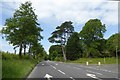
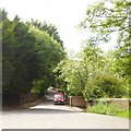
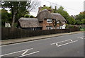
Photos of SN8 1TH
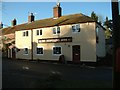
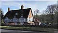
![Driveway to Manton Grange [1] in SN8 1TH](https://images.propbar.co.uk/images/geograph/53/34/5334025_120.jpg)
99 photos from this area
Area Information
Key information about the SN8 1TH including its size, population, and administrative classification.
- Area Type
- Postcode
- Area Size
- 1.2 hectares
- Population
- 1205
- Population Density
- 591 people/km²
House Prices in SN8 1TH
12
Properties
£408,778
Average Sold Price
£129,500
Lowest Price
£700,000
Highest Price
Showing 12 properties
| Address | Type | Beds | Baths | Last Sale Price | Last Sale Date | |
|---|---|---|---|---|---|---|
| 6 Golding Avenue, Marlborough, SN8 1TH | Detached | 4 | 2 | £700,000 | Jul 2025 | |
| 14 Golding Avenue, Marlborough, SN8 1TH | Detached | 3 | 1 | £430,000 | Jun 2024 | |
| 8 Golding Avenue, Marlborough, SN8 1TH | house | - | - | £590,000 | Feb 2020 | |
| 1 Golding Avenue, Marlborough, SN8 1TH | Detached | 4 | 2 | £575,000 | Sep 2018 | |
| Beech Cottage, Golding Avenue, Marlborough, SN8 1TH | house | - | - | £610,000 | Jul 2015 | |
| 3 Golding Avenue, Marlborough, SN8 1TH | Detached | - | - | £250,000 | Mar 2002 | |
| 4 Golding Avenue, Marlborough, SN8 1TH | Detached | - | - | £249,500 | Jul 2000 | |
| 10 Golding Avenue, Marlborough, SN8 1TH | Detached | - | - | £129,500 | Jul 1997 | |
| 5 Golding Avenue, Marlborough, SN8 1TH | Detached | - | - | £145,000 | Nov 1996 | |
| Preshute Vicarage, 7 Golding Avenue, Marlborough, SN8 1TH | Detached | 4 | 2 | - | - |
Page 1 of 2
Energy Efficiency in SN8 1TH
Amenities
Schools
| Rank | School | Type | Entry gender | Ages |
|---|
Explore more schools in this area
Go to Schools tabDemographics
Household Size
Two person
most common
Accommodation Type
Houses
most common
Tenure
83
majority
Ethnic Group
White
most common
Religion
N/A
most common
Household Composition
N/A
most common
Age
47
median
Adults (30-64 years)
most common
Household Deprivation
N/A
with no deprivation
NS-SEC
55
in Lower managerial occupations
Explore more demographic insights in this area
Go to Demographics tabPlanning
Planning Constraints
- Flood RiskPremium
- Ramsar Wetland SitesPremium
- Area of Outstanding Natural BeautyPremium
- Protected Nature ReservePremium
- Protected WoodlandPremium