Area Overview for SN8 1RF
Photos of SN8 1RF
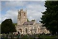
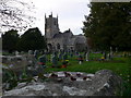
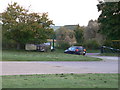
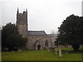
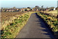
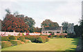
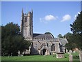
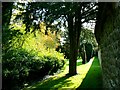
100 photos from this area
Area Information
Key information about the SN8 1RF including its size, population, and administrative classification.
- Area Type
- Postcode
- Area Size
- 25.1 hectares
- Population
- 1559
- Population Density
- 27 people/km²
House Prices in SN8 1RF
38
Properties
£521,364
Average Sold Price
£230,000
Lowest Price
£1,355,000
Highest Price
Showing 38 properties
| Address | Type | Beds | Baths | Last Sale Price | Last Sale Date | |
|---|---|---|---|---|---|---|
| The Old Bakehouse, High Street, Avebury, SN8 1RF | Terraced | 3 | - | £625,000 | Jun 2023 | |
| St Andrews Cottage, High Street, Avebury, SN8 1RF | Semi-detached | 3 | 1 | £535,000 | Mar 2022 | |
| Rosemead, High Street, Avebury, SN8 1RF | Terraced | 4 | 2 | £650,000 | Oct 2021 | |
| Fowlers Cottage, High Street, Avebury, SN8 1RF | house | 2 | 1 | £295,000 | Jun 2021 | |
| Teachers Cottage, High Street, Avebury, SN8 1RF | house | - | - | £290,000 | Apr 2021 | |
| The Old Vicarage, High Street, Avebury, SN8 1RF | house | - | - | £1,355,000 | Feb 2021 | |
| Rose Cottage, High Street, Avebury, SN8 1RF | house | - | - | £370,000 | Apr 2014 | |
| Fosse House, High Street, Avebury, SN8 1RF | house | - | - | £535,000 | Jul 2012 | |
| Hollis Cottage, High Street, Avebury, SN8 1RF | Terraced | - | - | £230,000 | Jan 2005 | |
| Ashdown House, High Street, Avebury, SN8 1RF | Terraced | - | - | £620,000 | Feb 2003 |
Page 1 of 4
Energy Efficiency in SN8 1RF
Amenities
Schools
| Rank | School | Type | Entry gender | Ages |
|---|
Explore more schools in this area
Go to Schools tabDemographics
Household Size
Two person
most common
Accommodation Type
Houses
most common
Tenure
70
majority
Ethnic Group
White
most common
Religion
N/A
most common
Household Composition
N/A
most common
Age
47
median
Adults (30-64 years)
most common
Household Deprivation
N/A
with no deprivation
NS-SEC
45
in Lower managerial occupations
Explore more demographic insights in this area
Go to Demographics tabPlanning
Planning Constraints
- Flood RiskPremium
- Ramsar Wetland SitesPremium
- Area of Outstanding Natural BeautyPremium
- Protected Nature ReservePremium
- Protected WoodlandPremium