Area Overview for SN6 7ND
Photos of SN6 7ND
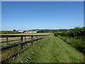
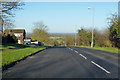
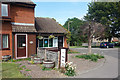
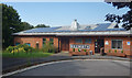
15 photos from this area
Area Information
Key information about the SN6 7ND including its size, population, and administrative classification.
- Area Type
- Postcode
- Area Size
- 2.4 hectares
- Population
- 1328
- Population Density
- 5186 people/km²
House Prices in SN6 7ND
56
Properties
£169,512
Average Sold Price
£38,500
Lowest Price
£340,000
Highest Price
Showing 56 properties
| Address | Type | Beds | Baths | Last Sale Price | Last Sale Date | |
|---|---|---|---|---|---|---|
| 101 Knowlands, Highworth, Swindon, SN6 7ND | Terraced | 2 | 1 | £242,000 | Jun 2025 | |
| 94 Knowlands, Highworth, Swindon, SN6 7ND | Terraced | 2 | 1 | £198,500 | Aug 2024 | |
| 92 Knowlands, Highworth, Swindon, SN6 7ND | Terraced | 2 | 1 | £204,000 | Jul 2024 | |
| 74 Knowlands, Highworth, Swindon, SN6 7ND | Terraced | 2 | 1 | £211,000 | Jul 2024 | |
| 108 Knowlands, Highworth, Swindon, SN6 7ND | house | 2 | 1 | £238,000 | Aug 2023 | |
| 96 Knowlands, Highworth, Swindon, SN6 7ND | Terraced | 2 | 1 | £225,000 | Aug 2023 | |
| 113 Knowlands, Highworth, Swindon, SN6 7ND | Terraced | 3 | 1 | £340,000 | Nov 2022 | |
| 105 Knowlands, Highworth, Swindon, SN6 7ND | house | - | - | £202,500 | Sep 2022 | |
| 80 Knowlands, Highworth, Swindon, SN6 7ND | house | - | - | £210,000 | Sep 2022 | |
| 77 Knowlands, Highworth, Swindon, SN6 7ND | Terraced | 2 | 1 | £220,000 | Aug 2022 |
Page 1 of 6
Energy Efficiency in SN6 7ND
Amenities
Schools
| Rank | School | Type | Entry gender | Ages |
|---|
Explore more schools in this area
Go to Schools tabDemographics
Household Size
Two person
most common
Accommodation Type
Houses
most common
Tenure
76
majority
Ethnic Group
White
most common
Religion
N/A
most common
Household Composition
N/A
most common
Age
47
median
Adults (30-64 years)
most common
Household Deprivation
N/A
with no deprivation
NS-SEC
36
in Lower managerial occupations
Explore more demographic insights in this area
Go to Demographics tabPlanning
Planning Constraints
- Flood RiskPremium
- Ramsar Wetland SitesPremium
- Area of Outstanding Natural BeautyPremium
- Protected Nature ReservePremium
- Protected WoodlandPremium